Delaware & Raritan Canal
- D-R Canal - Amwell Rd ( 40.50340, -74.58268 )
- D-R Canal - Blackwells Mills ( 40.47550, -74.57220 )
- D-R Canal - Griggstown (N) ( 40.43834, -74.61397 )
- D-R Canal - Griggstown (S) ( 40.42912, -74.61816 )
- D-R Canal - Kingston (N) ( 40.37489, -74.61854 )
- D-R Canal - Kingston (S) ( 40.37326, -74.61861 )
- D-R Canal - Lawrence (N) ( 40.27450, -74.70332 )
- D-R Canal - Lawrence (S) ( 40.26746, -74.71071 )
- D-R Canal - Lawrenceville ( 40.30501, -74.68490 )
- D-R Canal - Manville ( 40.52861, -74.58178 )
- D-R Canal - New Brunswick ( 40.50806, -74.46376 )
- D-R Canal - North Trenton ( 40.24901, -74.72865 )
- D-R Canal - Plainsboro (E) ( 40.34321, -74.62964 )
- D-R Canal - Plainsboro (W) ( 40.34190, -74.63758 )
- D-R Canal - Princeton (N) ( 40.33879, -74.64715 )
- D-R Canal - Princeton (S) ( 40.33177, -74.65282 )
- D-R Canal - Province Line Rd ( 40.30273, -74.68819 )
- D-R Canal - Rocky Hill ( 40.39826, -74.62702 )
- D-R Canal - Somerset (N) ( 40.54077, -74.51404 )
- D-R Canal - Somerset (S) ( 40.52390, -74.49248 )
- D-R Canal - South Bound Brook ( 40.55880, -74.53118 )
- D-R Canal - Trenton (N) ( 40.23886, -74.74194 )
- D-R Canal - Trenton (S) ( 40.18384, -74.74666 )
- D-R Canal - West Windsor ( 40.30844, -74.67979 )
- D-R Feeder Canal - Bull Island ( 40.41036, -75.03421 )
- D-R Feeder Canal - Ewing ( 40.26529, -74.84790 )
- D-R Feeder Canal - Lambertville (S) ( 40.34206, -74.94044 )
- D-R Feeder Canal - Rt 202 ( 40.37987, -74.95175 )
- D-R Feeder Canal - Washington Crossing ( 40.29842, -74.86852 )
- D-R Feeder Canal - West Trenton ( 40.24497, -74.81917 )
- Lake Carnegie - Plainsboro ( 40.34362, -74.62973 )
- Millstone River - Amwell Rd ( 40.50294, -74.58755 )
- Millstone River - Blackwells Mills ( 40.47487, -74.57503 )
- Millstone River - Griggstown ( 40.43893, -74.61757 )
- Millstone River - Kingston ( 40.37419, -74.61962 )
- Millstone River - Manville ( 40.53124, -74.58753 )
- Millstone River - Plainsboro (N) ( 40.34262, -74.62981 )
- Millstone River - Rocky Hill (N) ( 40.39957, -74.62809 )
- Millstone River - Rocky Hill (S) ( 40.39969, -74.62867 )
- Stony Brook - Princeton ( 40.33219, -74.65340 )
The blue line on the map is the Delaware & Raritan, or D&R, Canal. The canal is a basically 40-mile-long pond. The water flows very slowly from west to east; it is essentially still. Access points generally coincide with bridges or locks.
The thin red line is the “fall line” – the nominal division between uplands and lowlands. It appears the builders of the canal wanted to stay above the fall line for the entire length, and followed the Millstone and Raritan Rivers. The series of dams resulting in a chain of lakes along the Lawrence Brook reveals a shorter alternate route the canal might have taken. These dams were not built until over 100 years later. Perhaps surveying in the 1830s was not good enough to discover this, or perhaps it would not work, but it certainly looks like it should.

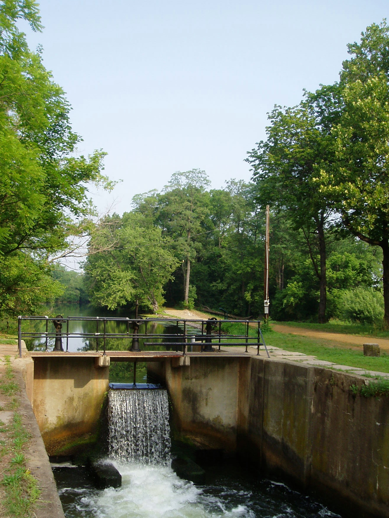
Locks on the canal occur roughly every two miles. The locks are impassible, although easily portaged around. This breaks the canal up into many sections of 4-5 miles round-trip, lock-to-lock. Starting at the right or eastern-most point, the markers on the map are:
New Brunswick – Boyd Park
You could get in here at the north end, but it is so small – why bother?
New Brunswick – Landing Lane
Parking is very limited. From here you can go a short ways downstream (east) to the impoundment at the end of the canal, where I have seen a lot of nice catfish caught. Or you can go under the bridge or over the road, and go west several miles up to:
Franklin – DeMott Lane
My favorite spot. Not a lot of parking, but never seen it full. From here you can go either direction for several miles – very picturesque, especially in the fall.

Franklin – Easton Avenue
Similar to DeMott Lane, you can go directly south under 287, or north after a short portage around the lock. Plenty of parking. Easton Avenue is very close by – traffic noise in many places.
South Bound Brook – Canal Road
A mirror image of the previous entry, but no footbridge across the canal.
Manville – Weston Canal Road
Now you are out in the country. Probably too far to portage to the Millstone River, on a fairly busy road.
East Millstone – Amwell Road
Not terrible access to the Millstone River here, less than a quarter mile away.
Blackwell’s Mills – Blackwell’s Mills Causeway
Not terrible access to the Millstone River here, less than a quarter mile away.
Griggstown – Griggstown Causeway
Rocky Hill – Franklin Turnpike
A pretty short portage to the Millstone River.
Kingston – Route 27 (Old Lincoln Highway)
A short portage between the canal and the Millstone River, with Lake Carnegie not far away. Good parking.
Plainsboro – Mapleton Rd
From here you can go five directions:
- North on the canal
- North on Lake Carnegie
- South on the canal (portage over the causeway)
- South on Lake Carnegie
- South on the Millstone River

Plenty of parking and porta-johns. The difference in water level between the lake and the canal is about two feet.
Princeton Junction – Lower Harrison Street & Washington Road
Limited parking.
Princeton Junction – Alexander Street
Easy access to both the canal and the Stony Brook. Plenty of parking.
Princeton – Quaker Road
Port Mercer – Quaker Road
Port Mercer – Province Line Road
Parking.
Lawrence – Bakers Basin Road
Little parking.
Lawrence – Carnegie Road
Parking.
Ewing – Whitehead Road
Parking.
Trenton – Mulberry Street
End of the line. Parking?
My favorites are the two spots in Franklin, just north of New Brunswick.
The canal does not actually end in Trenton, it just goes underground, and emerges again to the west, where it connects with the feeder canal that runs north along the Delaware River for another 20 miles. South of Trenton, disconnected remnants of the main canal still hold water along the railway down to Bordentown. Scroll the map a little more, and you can see there are more canals along the other side of the river in Pennsylvania. That’s something for another day.
At the New Brunswick end, part of the canal was filled-in to build Route 18 in New Brunswick, and the water spills down into the river. Further down the river, just past Route 27, is a small disconnected remnant of the canal, with the re-built terminal locks. It’s an interesting park, but too small to bother paddling, although there is a boat ramp to the river.
The Feeder canal is also accessible in a number of places.
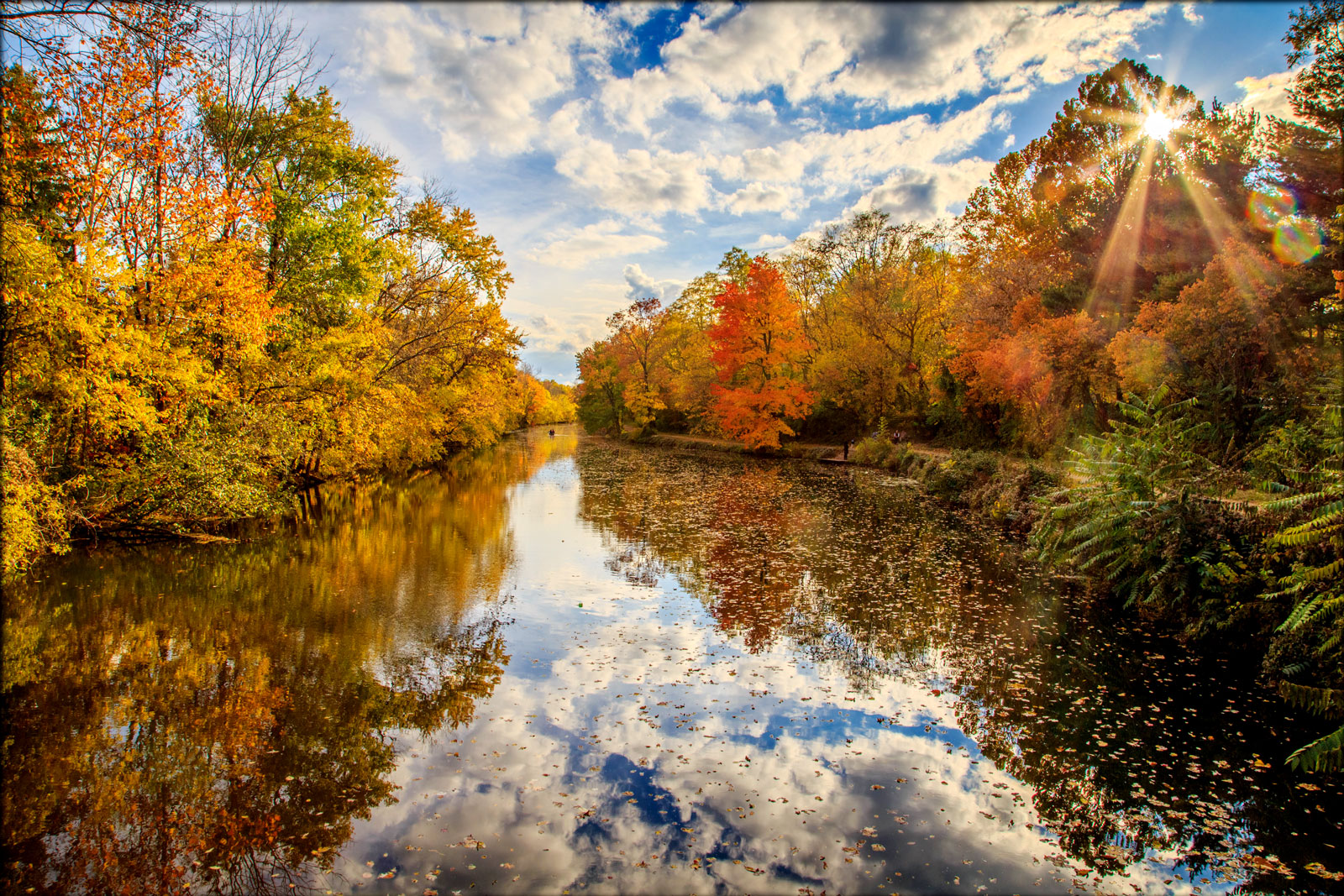
Most of the access points offer a choice of direction – ‘upstream’ or ‘downstream’, or both if you’re feeling ambitious. If you get tired of paddling, fishing includes sunnies, bass, crappie, yellow perch, and some pretty big channel cats in the deeper basins. Also a nice place for photography, especially in the fall when the colors reflect on the still water. In some places, the canal runs pretty close to some busy roads, and the noise can be a bother.
From Wikipedia:
The Delaware and Raritan Canal (D&R Canal) is a canal in central New Jersey, United States, built in the 1830s, that served to connect the Delaware River to the Raritan River. It was an efficient and reliable means of transportation of freight between Philadelphia and New York City, especially coal from the anthracite fields in eastern Pennsylvania. The canal allowed shippers to cut many miles off the existing route from the Pennsylvania coal fields, down the Delaware, around Cape May, and up along the (occasionally treacherous) Atlantic Ocean coast to New York City.
The main section of the canal runs from Bordentown on the Delaware to New Brunswick on the Raritan. A feeder canal section (which feeds water into the main canal) stretches 22 miles (35 km) northward from Trenton, upstream along the east bank of the Delaware to Bull’s Island near Frenchtown. The feeder canal collects water from higher elevations to the north, and feeds it to the highest section of the main canal, which flows generally north and east to the end, and had flowed south into the Crosswicks Creek at Bordentown. The total length of the entire canal system was approximately 66 miles. The main section was 44 miles long, 75 feet wide and 8 feet deep; the feeder was 22 miles long, 60 feet wide and 6 feet deep.
Altered and Abandoned Sections
A section of the main D&R Canal in Trenton has been covered over (the water still flows below) by the Trenton Freeway (U.S. Route 1) and is inaccessible to public use. The portion of the canal that provided access to the Delaware River in Bordentown is also abandoned. In Trenton it has been covered by Route 129, which opened in 1996. Another section south of Trenton is located in Hamilton Township, Mercer County, New Jersey between the southern boundary of Trenton and the Crosswicks Creek.
Locks and Spillways
Locks were used to overcome elevation differences along the D&R canal. Many of the locks are still present along the canal route; however, the lock gates have been replaced on the upstream side with small dams and water outfalls. The downstream gates have been removed, so the water in the locks is level with the water on the downstream side. Some of the locks have been buried or removed due to construction projects in the vicinity of the canal.
A number of spillways, which drained excess water from the canal into nearby waterways during periods of heavy flow, are located along the canal route. Spillways are evident as a dip in the tow path along the canal. Some have paving stones spaced closely enough for mules to walk, but are impassable for bicycles. With the flow stopped, species typical of stagnant water live in them.

Associated Rivers
Delaware River – Feeds the Delaware and Raritan Canal via a feeder canal that approaches from the north along the east bank of the Delaware River, starting at Bulls Island, to the southern terminus of the D&R Canal near Trenton.
Millstone River – Parallels the Delaware and Raritan Canal from Princeton north to Manville. A flood control study is currently being conducted for the Millstone River basin by two government organizations, which may affect the Delaware and Raritan Canal in the future.
Raritan River – Parallels the Delaware and Raritan Canal from Manville north and east to New Brunswick. The northern terminus of the Delaware and Raritan Canal is in New Brunswick.
Landmark
The Delaware and Raritan Canal was added to the National Register of Historic Places on May 11, 1973. The many historic canal houses where the bridge tenders have lived (such as the Blackwells Mills Canal House and the Port Mercer Canal House) were listed as contributing properties.
State Park
In 1974, most of the canal system was declared a New Jersey state park. It remains one today, and is used for canoeing, kayaking, and fishing. A graded natural-surface trail along the side of the canal, which was the tow path that mules used to tow barges on the canal before steam powered barges, is now used for hiking, jogging, bicycling, and horseback riding. Some 36 miles of the main canal, and all 22 miles of the feeder canal, still exist. The feeder canal along the Delaware, being a former railroad rather than a towpath, is especially suited to bicycling. The park is operated and maintained by the New Jersey Division of Parks and Forestry.
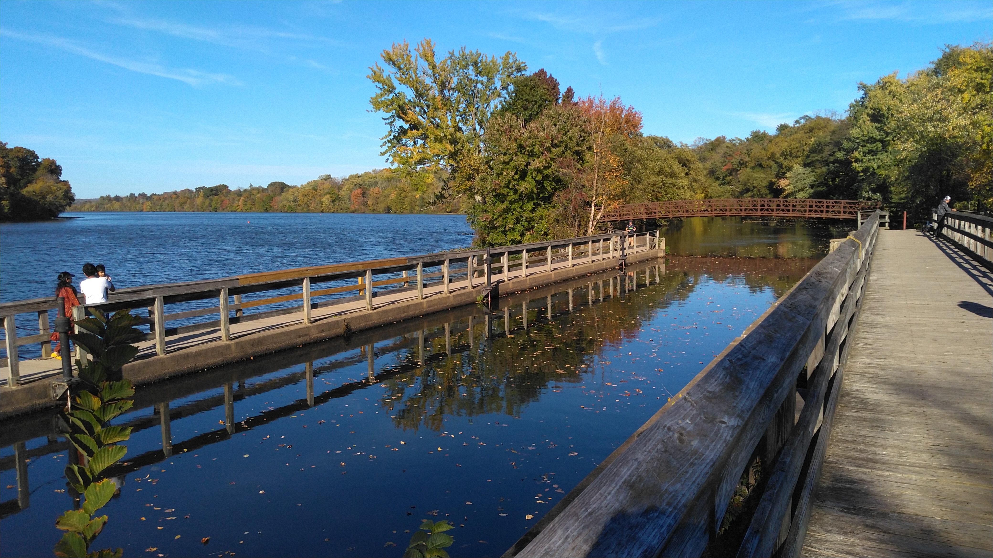
The canal is accessible from many points along its route, with small parking areas providing access at most road crossings. One of the most scenic and popular sections of the D&R Canal state park is the segment along Lake Carnegie in Princeton, New Jersey, which features the canal on one side of the path and the lake on the other side. Another attractive section borders the Colonial Park Arboretum and Gardens in East Millstone.
When the canal was used for transportation, New Jersey’s landscape was mostly rural, and its primary business was agriculture. “Now,” in the words of Howard Green, research director of the New Jersey Historical Commission, “It is one of the most beloved parks in the state, a sinewy, snake-like greenway through one of the most heavily populated parts of the world. It has gone from being the machine in the garden, to being garden in the machine.”
Questions or Inquiries?
Just want to say Hello? Sign the .