Farrington Lake - North Brunswick

Farrington Lake
( 40.43371, -74.47122 )

  1. Davidson's Mill Pond - East Brunswick ( 40.41117, -74.49789 )
  2. Farrington Lake - East Brunswick (C) ( 40.42465, -74.47680 )
  3. Farrington Lake - East Brunswick (N) ( 40.43900, -74.46646 )
  4. Farrington Lake - East Brunswick (S) ( 40.42201, -74.48242 )
  5. Lawrence Brook - Milltown (E) ( 40.45144, -74.43663 )
  6. Lawrence Brook - Milltown (W) ( 40.44831, -74.44367 )
  7. Weston's Mill Pond - East Brunswick ( 40.46677, -74.42603 )

This is the biggest of the lakes and ponds created by damming the Lawrence Brook. The map is centered on the northernmost launch site, which is the most central on the lake. There are two more access points to the south, which can be useful if you want to explore up the Lawrence Brook.

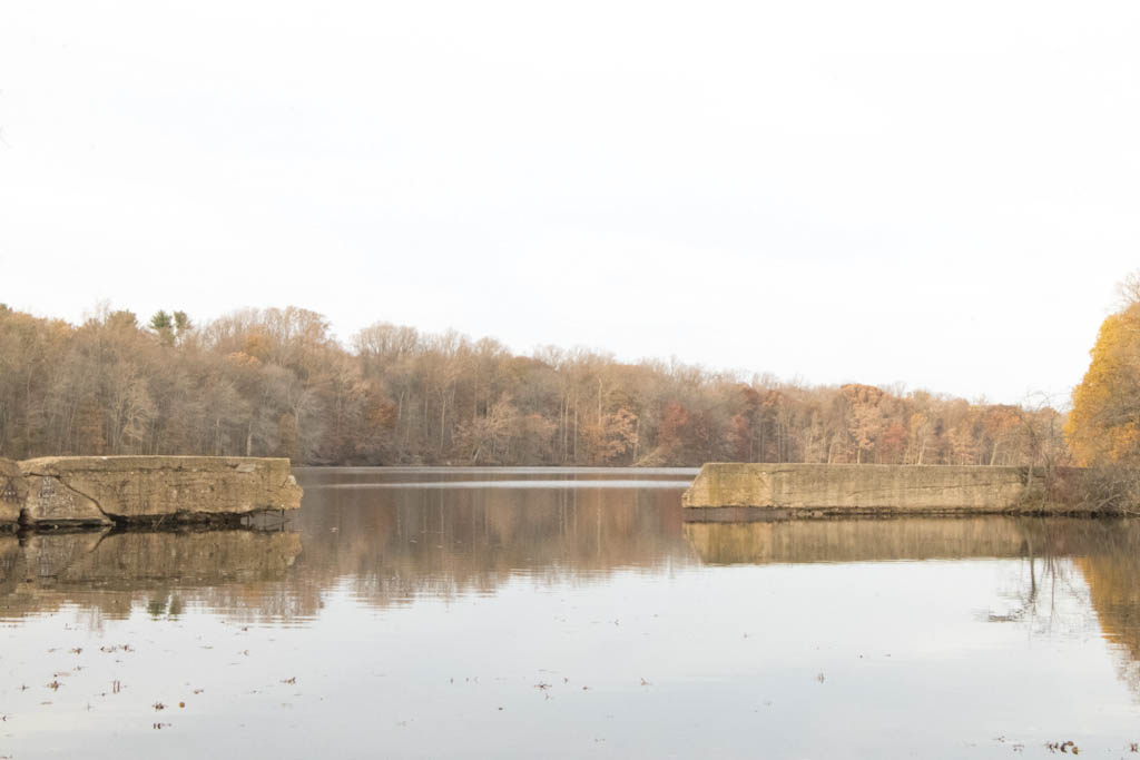
Farrington Lake is named after Edward Farrington, mayor of New Brunswick, New Jersey, in 1915-1918, who envisioned the construction of the dam to supply water to his city. Mayor Farrington died while in office in 1918. The lake covers about 290 acres and has a mean depth of 6.6 feet with a maximum depth of 13 feet. This lake is long and narrow - a good long paddle in either direction; I've never done both ends in one day. None of the bridges are low or difficult, in fact I have used Hardenburg Lane to get out of the rain. The lake has some odd coves along the south shore that are interesting to explore. The dam at the north end is pretty big, and I wouldn't get too close if the water is high and running over the top.

As part of the water supply for New Brunswick, the level of the lake is subject to supply and demand. The actual pumping station is downstream on Weston's Mill Pond, and Farrington Lake is drawn-down as necessary to keep that lake full(ish). I have seen Weston's Mill Pond drawn-down a foot or two, but in September 2025, Farrington Lake was drawn-down over 3 feet. Considering it has a mean depth of about six feet, that's a lot. Most of the docks on the lake were high-and-dry. The banks recede quite a bit, but the bottom is sand and gravel, so it's not a problem for launching like Weston's Mill pond, which becomes a mucky mess.

What is this? Nearby Bicentennial Park was once the summer residence of a wealthy New Yorker who built this "dam" to impound an area and create a private water hole for swimming/fishing/canoeing/ice-skating etc. The impounded area is oddly rectangular, and seems artificial. My guess is that the structure pre-dates the lake itself and was filled by pumping water up from the Lawrence Brook, as there is no other water source entering the impoundment. After a few years, ice broke the wall, which is only about about 2 feet thick, and it was never fixed. When Farrington Lake was created, there was no more need for a private pond, and the center of the wall was demolished to connect with the new lake. Or maybe I have this all wrong, if anyone knows, please share.

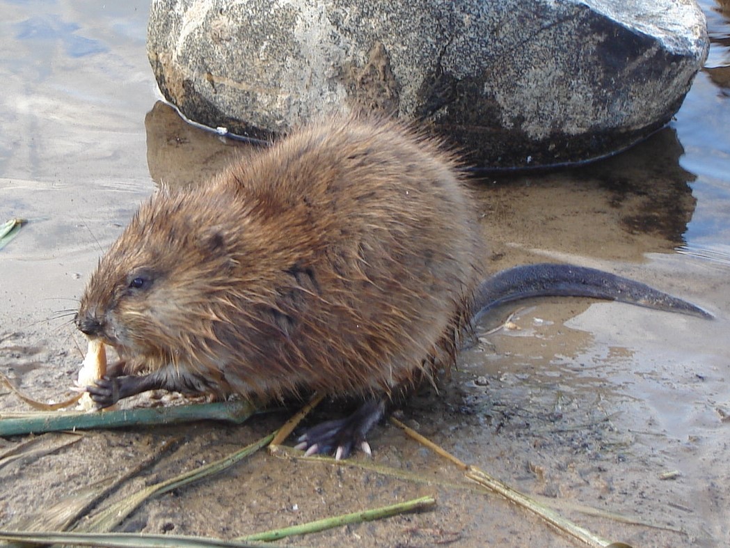
The brook goes up to the dam that forms Davidson's Millpond, which is accessible, but quite small. Beyond there the brook peters-out pretty quickly, and Dean's Pond is now dried-up. On the downstream side, Lawrence Brook flows through Mill Pond to Weston's Mill Pond. That lake has otters, so there are probably otters in this lake as well, but I've never seen any. There may also be beaver in Farrington Lake.

Farrington Lake - East Brunswick (N)
( 40.43900, -74.46537 )

  1. Dallenbach Pond ( 40.41254, -74.44296 )
  2. Davidson's Mill Pond - East Brunswick ( 40.41117, -74.49789 )
  3. Farrington Lake - East Brunswick (C) ( 40.42465, -74.47680 )
  4. Farrington Lake - East Brunswick (N) ( 40.43900, -74.46646 )
  5. Farrington Lake - East Brunswick (S) ( 40.42201, -74.48242 )
  6. Lawrence Brook - Milltown (E) ( 40.45144, -74.43663 )
  7. Lawrence Brook - Milltown (W) ( 40.44831, -74.44367 )
  8. Weston's Mill Pond - East Brunswick ( 40.46677, -74.42603 )

This is the best entry point, with convenient parking, a nice clean launch area, and access to both ends of the lake.

Farrington Lake - East Brunswick (C)
( 40.42465, -74.47680 )

  1. Dallenbach Pond ( 40.41254, -74.44296 )
  2. Davidson's Mill Pond - East Brunswick ( 40.41117, -74.49789 )
  3. Farrington Lake - East Brunswick (C) ( 40.42465, -74.47680 )
  4. Farrington Lake - East Brunswick (N) ( 40.43900, -74.46646 )
  5. Farrington Lake - East Brunswick (S) ( 40.42201, -74.48242 )
  6. Lawrence Brook - Milltown (E) ( 40.45144, -74.43663 )
  7. Lawrence Brook - Milltown (W) ( 40.44831, -74.44367 )

Farrington Lake - East Brunswick (S)
( 40.42201, -74.48242 )

  1. Dallenbach Pond ( 40.41254, -74.44296 )
  2. Davidson's Mill Pond - East Brunswick ( 40.41117, -74.49789 )
  3. Farrington Lake - East Brunswick (C) ( 40.42465, -74.47680 )
  4. Farrington Lake - East Brunswick (N) ( 40.43900, -74.46646 )
  5. Farrington Lake - East Brunswick (S) ( 40.42201, -74.48242 )
  6. Lawrence Brook - Milltown (W) ( 40.44831, -74.44367 )

One thing I've always wondered is why the builders of the D&R Canal looped way up north to Bound Brook when they might have just cut six miles from Kingston to the Lawrence Brook, and built a series of dams from there to the Raritan River, as was done a hundred years later.


Comments on Farrington Lake - North Brunswick

Questions or Inquiries?

Just want to say Hello? Sign the .

Submit a Comment

Your email address will not be published. Required fields are marked *


Click image to replace if unable to read.

Enter the digits from the image above, except for the last one:

This site uses Akismet to reduce spam. Learn how your comment data is processed.


Atlantic County
( 39.49052, -74.63953 )

  1. Absecon Creek - Absecon ( 39.42635, -74.48653 )
  2. Atsion Lake - Pinelands ( 39.73989, -74.73128 )
  3. Barnegat Bay - Brant Beach ( 39.61673, -74.20110 )
  4. Barnegat Bay - Parkertown ( 39.60978, -74.29231 )
  5. Barnegat Bay - Tuckerton ( 39.57671, -74.33078 )
  6. Barnegat Bay - West Creek ( 39.63100, -74.29618 )
  7. Bass River - New Gretna ( 39.57721, -74.45079 )
  8. Batsto Lake - Batsto ( 39.64682, -74.65327 )
  9. Batsto River - Wharton State Forest ( 39.71014, -74.66747 )
  10. Bay Avenue - Ocean City ( 39.21643, -74.64678 )
  11. Cedar Run - Stafford ( 39.64365, -74.24592 )
  12. Cedar Swamp Creek (N) ( 39.26195, -74.70206 )
  13. Cedar Swamp Creek (S) ( 39.24889, -74.71257 )
  14. Deep Run - Wharton State Forest ( 39.76288, -74.69219 )
  15. Dennis Creek - Jake's Landing ( 39.17916, -74.85133 )
  16. East Creek Pond - Dennis ( 39.22333, -74.88656 )
  17. Franklinville Lake - Franklinville ( 39.61768, -75.07867 )
  18. Gibson's Creek ( 39.35592, -74.72609 )
  19. Great Bay - Graveling Point ( 39.53959, -74.38821 )
  20. Great Bay - Great Bay Blvd (N) ( 39.56316, -74.34202 )
  21. Great Bay - Great Bay Blvd (S) ( 39.52160, -74.31849 )
  22. Great Bay - Motts Creek ( 39.51826, -74.43637 )
  23. Great Bay - Rand's Marina ( 39.53934, -74.32614 )
  24. Great Egg Harbor Bay - Beerdley's Point ( 39.28756, -74.62664 )
  25. Great Egg Harbor Bay - Somers Point (N) ( 39.31130, -74.59272 )
  26. Great Egg Harbor Bay - Somers Point (S) ( 39.30640, -74.60763 )
  27. Great Egg Harbor River - Camp Acagisca ( 39.49275, -74.76715 )
  28. Great Egg Harbor River - Mays Landing ( 39.44940, -74.72489 )
  29. Great Egg Harbor River - New Brooklyn ( 39.70187, -74.93732 )
  30. Great Egg Harbor River - Penny Pot ( 39.57547, -74.82239 )
  31. Great Egg Harbor River - Piney Hollow Rd ( 39.62049, -74.89280 )
  32. Great Egg Harbor River - Weymouth ( 39.51339, -74.77889 )
  33. Hammonton Lake ( 39.63010, -74.78734 )
  34. Indian Mills Lake ( 39.79554, -74.73998 )
  35. Inside Thorofare - Atlantic City ( 39.35533, -74.45687 )
  36. Inside Thorofare - Ventnor ( 39.34593, -74.47623 )
  37. Lake Absegami - Bass River ( 39.62529, -74.42760 )
  38. Lake Lenape - Mays Landing ( 39.46187, -74.73755 )
  39. Lake Nummy - Belleplain ( 39.24691, -74.85720 )
  40. Lakes Bay - Ventnor ( 39.35318, -74.48744 )
  41. Longport Dog Beach ( 39.30741, -74.55738 )
  42. Ludlam Thorofare - Sea Isle City ( 39.14373, -74.70499 )
  43. Makepeace Lake ( 39.54717, -74.75058 )
  44. Malaga Lake - Newfield ( 39.57878, -75.05643 )
  45. Manahawkin Lake - Stafford ( 39.69641, -74.26116 )
  46. Maurice River - Alliance Beach ( 39.50198, -75.07976 )
  47. Maurice River - Garden Road ( 39.52199, -75.07329 )
  48. Maurice River - Mauricetown ( 39.28730, -74.98763 )
  49. Maurice River - Milleville ( 39.37706, -75.03671 )
  50. Maurice River - Sharp St ( 39.40012, -75.05345 )
  51. Maurice River - West Side Park ( 39.49608, -75.07611 )
  52. Maurice River - Willow Grove ( 39.54996, -75.07146 )
  53. Miller Creek ( 39.25262, -74.62715 )
  54. Mullica River - Batsto ( 39.63973, -74.65889 )
  55. Mullica River - Crowley Landing ( 39.62640, -74.61922 )
  56. Mullica River - Hay Road Beach ( 39.57349, -74.53943 )
  57. Nacote Creek - Port Republic ( 39.51768, -74.49363 )
  58. Oswego Lake - Penn State Forest ( 39.73454, -74.49111 )
  59. Oswego River - Martha Bridge ( 39.68159, -74.51416 )
  60. Patcong Creek - Bargaintown Pond ( 39.36083, -74.57569 )
  61. Patcong Creek - Belhaven ( 39.34363, -74.58752 )
  62. Patcong Creek - New Road ( 39.30470, -74.62031 )
  63. Reeds Bay - Absecon ( 39.44306, -74.46194 )
  64. Scull Bay - Bridge Out ( 39.34668, -74.55683 )
  65. Somers Bay - Brigantine ( 39.40916, -74.36937 )
  66. Stafford Forge WMA - Manahawkin ( 39.66881, -74.32090 )
  67. Stephen Creek ( 39.38564, -74.73649 )
  68. Stephen Creek - Maple Lake ( 39.40547, -74.77808 )
  69. Stephen Creek - Stephen Lake ( 39.39556, -74.74907 )
  70. Strathmere Bay - Strathmere ( 39.19447, -74.66326 )
  71. Tennessee Ave - Ocean City ( 39.27051, -74.60393 )
  72. Tuckahoe River - Corbin City ( 39.29883, -74.75319 )
  73. Tuckahoe River - Tuckahoe ( 39.29545, -74.74010 )
  74. Union Lake - Millville (E) ( 39.40677, -75.05152 )
  75. Union Lake - Millville (W) ( 39.40812, -75.06712 )
  76. Wading River - Beaver Branch ( 39.65059, -74.51890 )
  77. Wading River - Bodine Field Road ( 39.65401, -74.52497 )
  78. Wading River - Evans Bridge ( 39.67517, -74.54066 )
  79. Wading River - Godfrey Bridge ( 39.68987, -74.54612 )
  80. Wading River - Harrisville Pond ( 39.66547, -74.52434 )
  81. Wading River - Hawkins Bridge ( 39.71442, -74.56595 )
  82. Wilson Lake - Glassboro ( 39.65715, -75.05088 )