Laurence Harbor / Cheesequake Creek

Laurence Harbor
( 40.45105, -74.27258 )

  1. Lake Lefferts - Matawan ( 40.41563, -74.23362 )
  2. Raritan Bay - Cliffwood (E) ( 40.45089, -74.22033 )
  3. Raritan Bay - Cliffwood (W) ( 40.45216, -74.22269 )
  4. Raritan Bay - Cliffwood (Whale Creek) ( 40.45090, -74.22274 )
  5. Raritan Bay - Keyport (W) ( 40.43921, -74.20160 )
  6. Raritan Bay - Laurence Harbor (E) ( 40.45877, -74.24622 )
  7. Raritan Bay - Laurence Harbor (W) ( 40.46223, -74.25482 )
  8. Raritan Bay - South Amboy (N) ( 40.48343, -74.27059 )
  9. Raritan Bay - South Amboy (S) ( 40.47946, -74.26831 )
  10. Raritan Bay - South Amboy Ramp ( 40.48401, -74.27416 )
  11. Raritan River - Perth Amboy ( 40.50057, -74.27712 )
  12. Wagner's Marina - Matawan Creek ( 40.43540, -74.21416 )

Much of this part or Raritan Bay is fenced-off because of lead pollution from the industrial slag used to build jetties and seawalls in the 1970s. Supposedly, most of it has been cleaned up, but the whole area remains 'off-limits'. Since the toxins leach into the water and are carried off by the currents, you really have to wonder about the entire bay. A quick search online will reveal more on this subject than you ever wanted to know.

The Raritan Bay Slag Superfund Site consists of a seawall along the coast of the Raritan Bay in the Laurence Harbor section of Old Bridge Township, New Jersey, United States. The seawall itself is made of slag. In this seawall, are large concentrations of lead, antimony, arsenic, and copper. The lead in particular has contaminated the nearby soil and surface water. The slag deposits are a by-product from NL Industries (formerly known as National Lead Company), a lead smelting company, dumping its wastes in the Raritan River. The New Jersey Department of Environmental Protection (NJDEP) investigated the area and found large concentrations of metals to be dangerous to human health. The NJDEP called the United States Environmental Protection Agency (EPA) to investigate the area further, which resulted in some of the slag being physically removed and the toxic areas being fenced off.

In September 2016, $7 million of federal funding was awarded to the region. The Superfund State Contract was signed in July 2016. Field work officially began in November 2016. Partial site cleanup was completed in late fall of 2017. In 2021, dissatisfied with the progress of the cleanup, the EPA took over control of the site. The EPA claimed that National Lead was essentially dragging its feet in showing progress in cleanup design studies, both in June of 2020 and April of 2021, that they still continued to lack sufficient detail and were deemed unacceptable. The takeover came five years after National Lead was given multiple extensions to provide the report.

https://en.wikipedia.org/wiki/Raritan_Bay_Slag_Superfund_Site

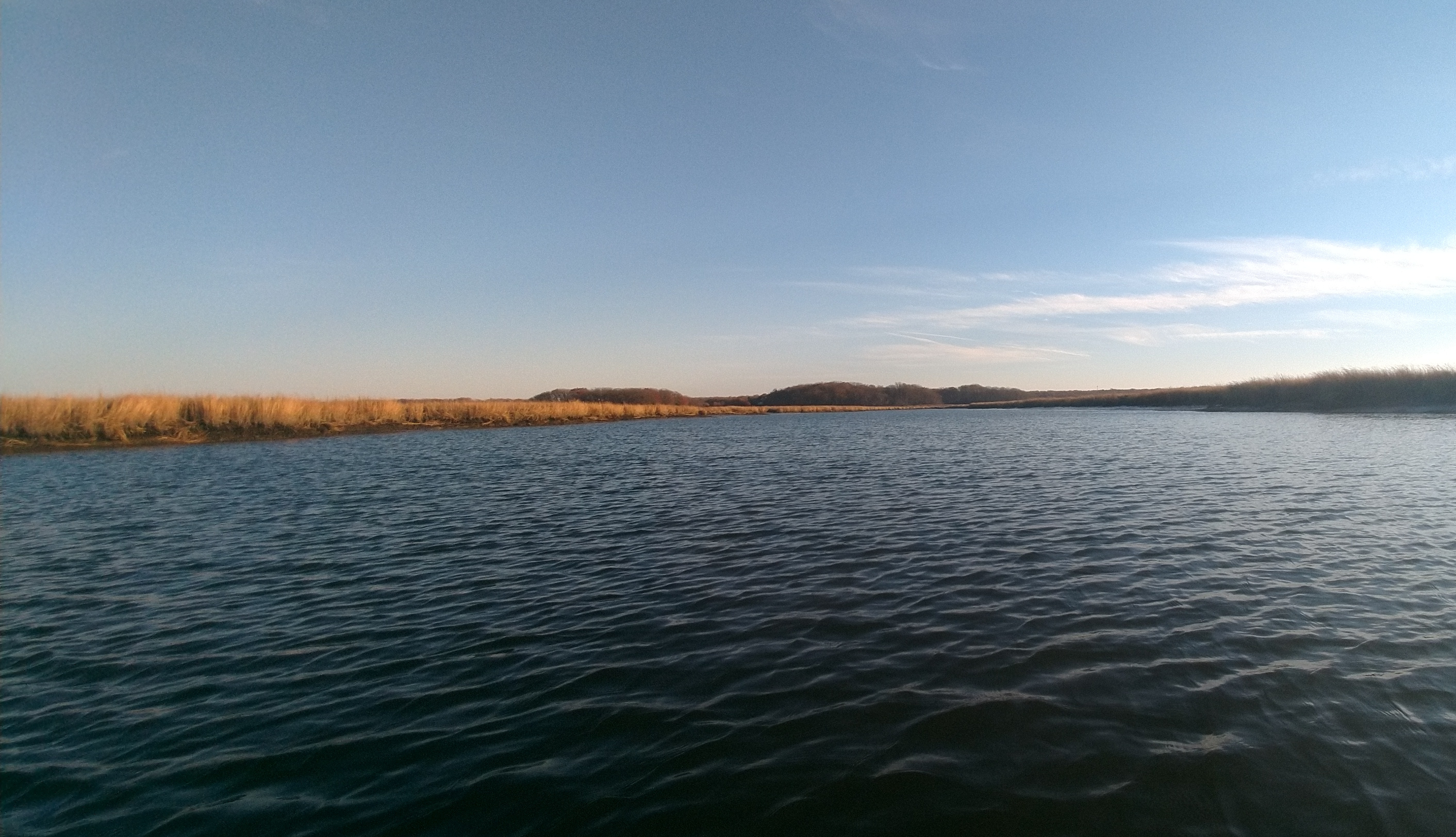
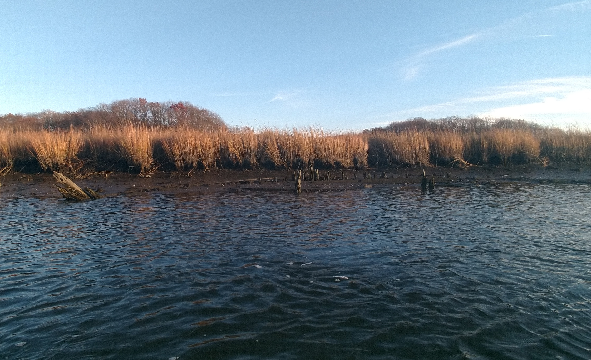
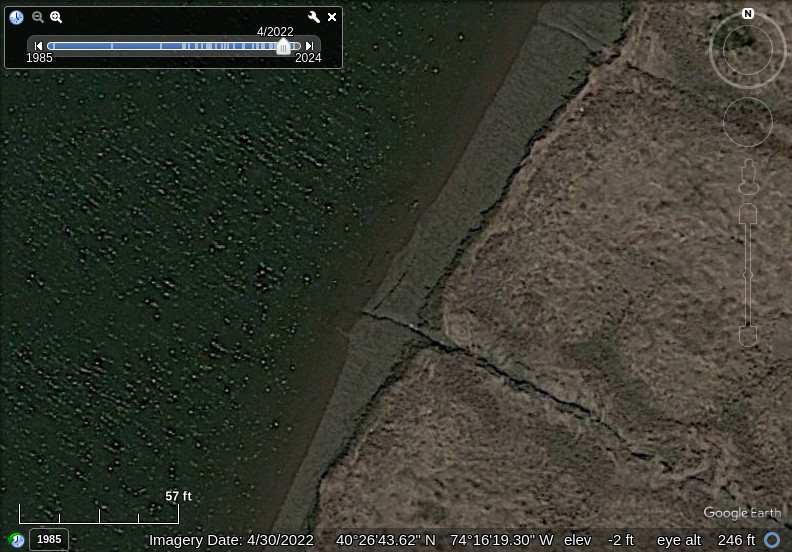
That said, I went there one warm but windy November day, and found the area quite nice, and the water crystal clear. I put in from the west parking lot on the little beach there, closest to the inlet. At low tide, this is more of a morass than a beach, but at high tide it wasn't bad at all. I made a quick paddle straight to the inlet, over the east jetty that was completely submerged. I crossed the channel and poked out past the end of the west jetty, but with a strong west wind, conditions on the unprotected side were not good, so I quickly headed back behind the shelter of the jetty and went up the creek.

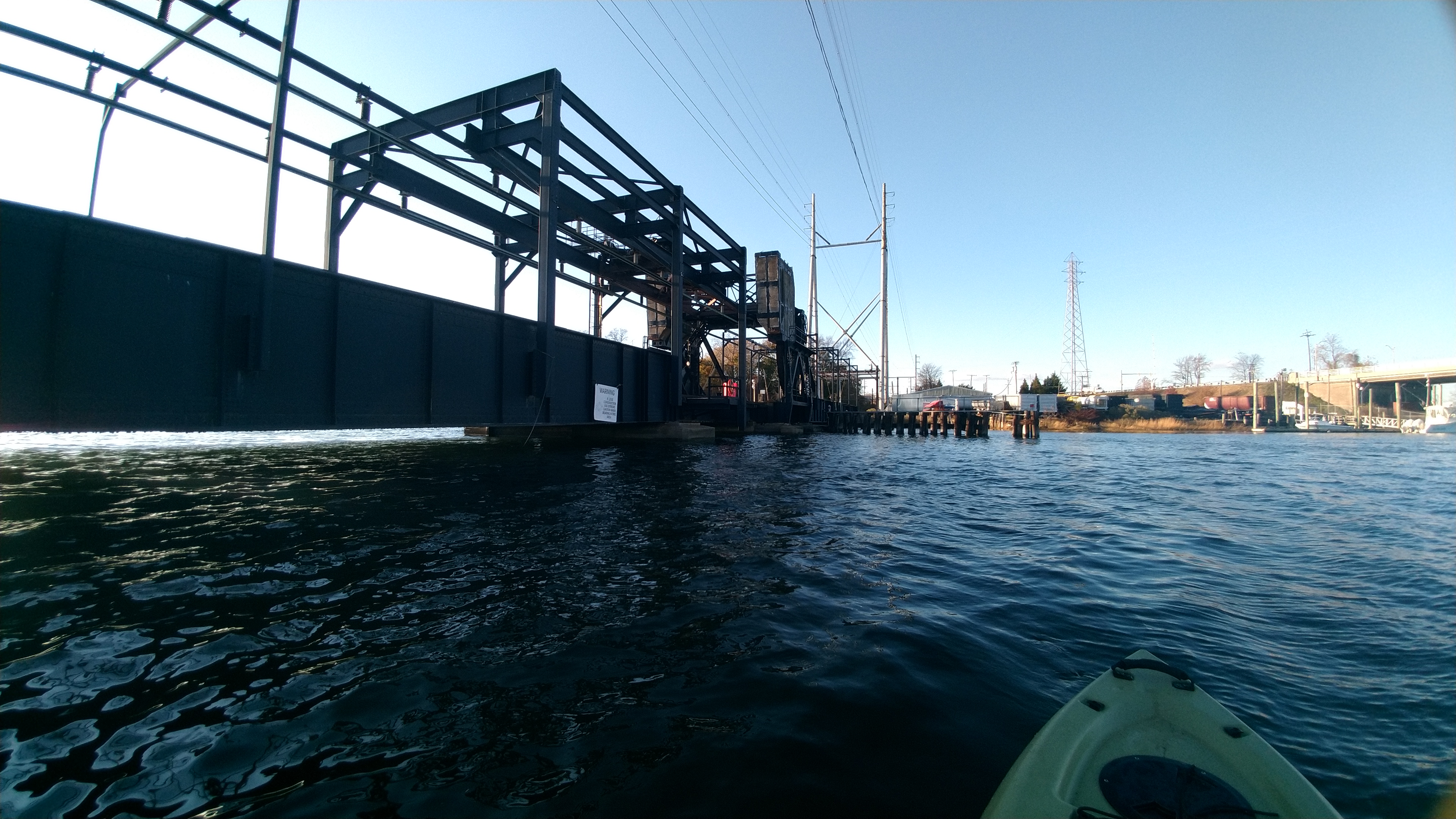
The Cheesequake Creek at this point would qualify as a river. However, the railroad bridge across the creek is normally down, only opening on demand, leaving about 2 feet of clearance at high tide. To get under that, you'd have to undo your seat back and lie down in the boat, going hand-over-hand under the bridge, then put it all back together. I didn't feel like doing all that, so I messed around in the side creek and the marina a bit, and called it a day. Don't make a bother of yourself in a marina. Someday I'll go all the way up the creek to Cheesequake Park.

At one point while I was inspecting the bottom of the railroad bridge, a train unexpectedly went over, which sounded like the end of the world.
Looking past my thumb through the Route 35 bridge towards the bay
The sun setting over the bay

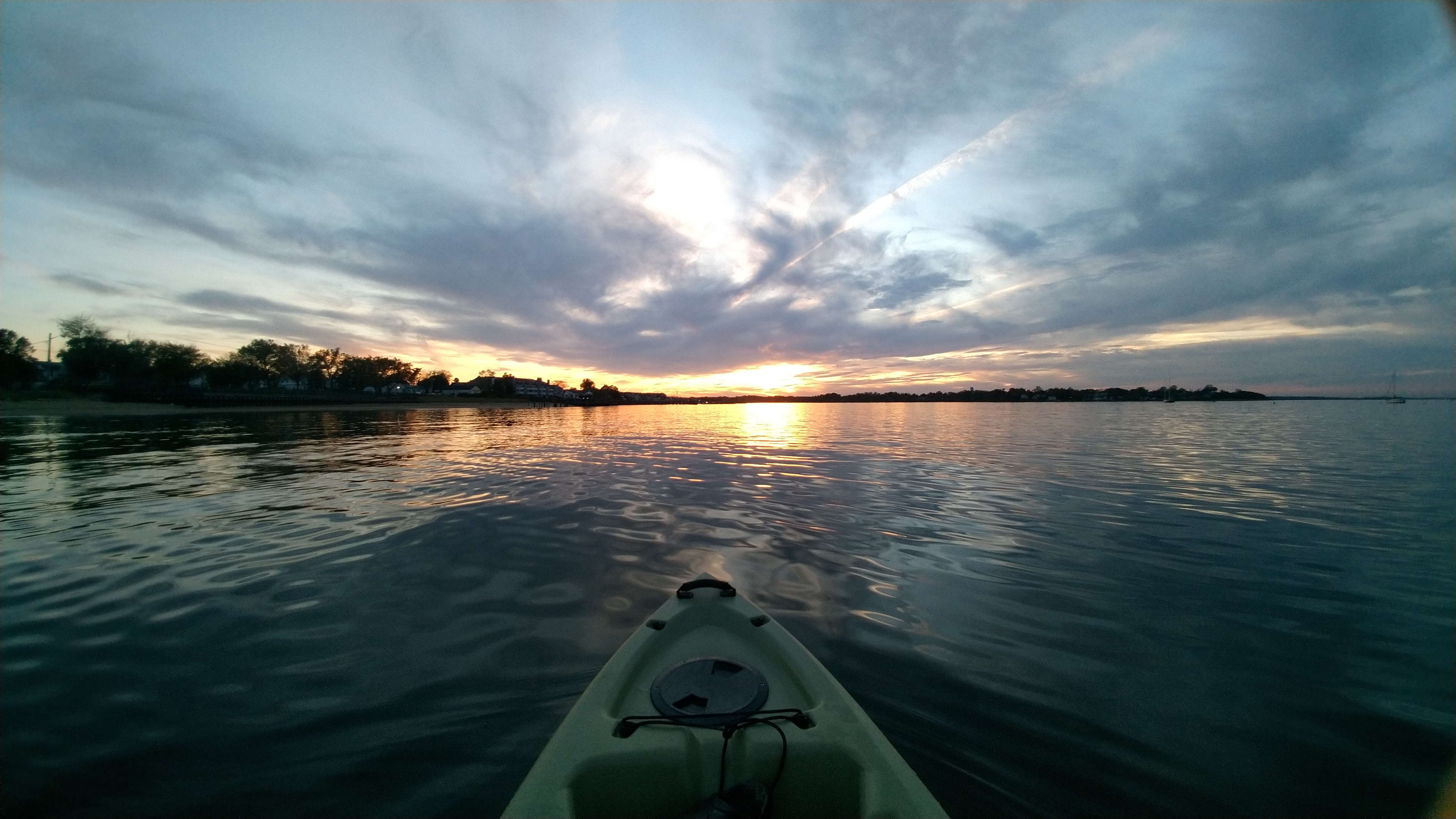
All in all, I was surprised how nice a trip this was. I think it was because it was almost winter. In the summer you'll find the whole area filthy and smelly, with heavy boat traffic.

A week later I got under the railroad bridge easily at low tide and went upstream. After a couple of marinas, this is all you see - a lot of marsh grass. Half a mile further and I would have been in the park. The crabbing bridge there is actually up a small side creek.
The remains of a wooden vessel in the mud at low tide. See the link below.
You can barely make it out in this satellite image
Tides

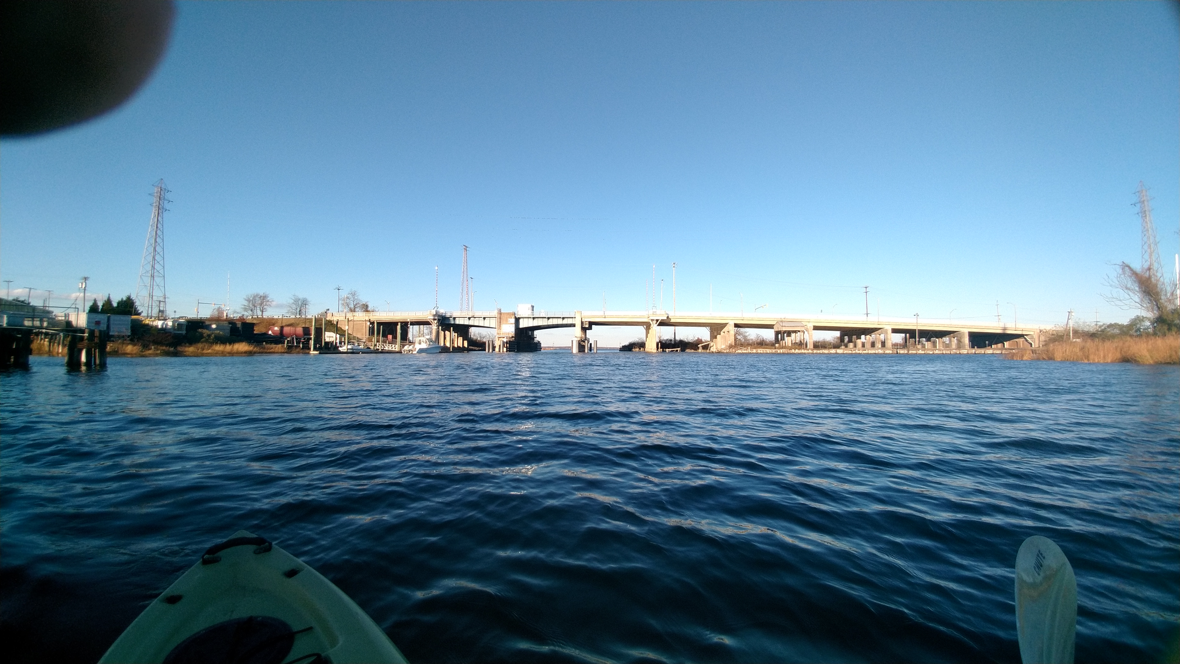
The draw of the S35 Bridge, at mile 0.0, at Morgan, South Amboy, New Jersey, shall operate as follows:

(1) From April 1 through November 30 from 7 a.m. to 8 p.m., the draw need only open on the hour. From 8 p.m. to 11 p.m. the draw shall open on signal. From 11 p.m. to 7 a.m. the draw shall open after at least a two hour advance notice is given by calling the number posted at the bridge.

(2) From December 1 through March 31, the draw shall open on signal after at least a two hour advance notice is given by calling the number posted at the bridge.

https://www.waterwayguide.com/bridge/3-1821/nj-35-bridge

An old postcard of the inlet and Cady's House of Seafood, built in 1926, burned-down in 1986, which I remember as the Robert E. Lee Inn. Because of the Superfund site, the lot remains empty to this day. I remember fishing these jetties as a kid. Don't remember catching anything though - just as well.

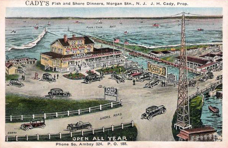
A sad side note to the pollution story is that in the 1990s the town invested quite a lot into developing the waterfront here, installing a boardwalk, snack bars, rest rooms, showers, and even a police substation, before the whole area was closed down by the EPA in 2012. Perhaps someday it will be re-opened. Nearby, the Cliffwood waterfront is coming along nicely.

Links

  • https://www.1stdibs.com/art/photography/black-white-photography/george-tice-wrecked-boat-cheesequake-creek-morgan-nj/id-a_204332
  • https://www.morgan-nj.org/blog/sample-page/bridges-roads-rails/bridges/the-bridges-of-cheesequake-creek/

In Cheesequake Park, the rangers occasionally conduct guided paddling tours, but to quote the NJDEP page for the park: "No access is permitted to the tidal creeks."


Comments on Laurence Harbor

Questions or Inquiries?

Just want to say Hello? Sign the .

Submit a Comment

Your email address will not be published. Required fields are marked *


Click image to replace if unable to read.

Enter the digits from the image above, except for the last one:

This site uses Akismet to reduce spam. Learn how your comment data is processed.


Passaic County
( 41.00761, -74.30215 )

  1. Branch Brook Park ( 40.75077, -74.18305 )
  2. Clinton Reservoir (N) ( 41.09734, -74.44232 )
  3. Clinton Reservoir (S) ( 41.09409, -74.44102 )
  4. Delaware River ( 40.17371, -74.84843 )
  5. Green Turtle Lake - West Milford ( 41.14896, -74.32896 )
  6. Greenwood Lake - Hewitt ( 41.15252, -74.34682 )
  7. Greenwood Lake - Warwick NY ( 41.21822, -74.29848 )
  8. Hackensack River - Bergenfield ( 40.92835, -74.03023 )
  9. Hackensack River - Foschini Park ( 40.88477, -74.03524 )
  10. Hackensack River - Meadowlands ( 40.80747, -74.05723 )
  11. Hackensack River - Secaucus (N) ( 40.80552, -74.04345 )
  12. Hackensack River - USS Ling ( 40.87939, -74.04029 )
  13. Lake Hopatcong - Ashley's Cove ( 40.96426, -74.61082 )
  14. Lake Hopatcong - Hopatcong (E) ( 40.92890, -74.63861 )
  15. Lake Hopatcong - Hopatcong (W) ( 40.91763, -74.66346 )
  16. Lamington/Black River - Route 10 ( 40.86048, -74.62893 )
  17. Monksville Reservoir - West Milford (N) ( 41.14241, -74.30055 )
  18. Monksville Reservoir - West Milford (S) ( 41.12695, -74.30127 )
  19. Monksville Reservoir - West Milford (W) ( 41.13686, -74.30684 )
  20. Mountain Lake - Denville ( 40.88952, -74.44225 )
  21. Orange Reservoir - Rahway River ( 40.75964, -74.28903 )
  22. Overpeck Creek - Teaneck ( 40.86648, -74.00077 )
  23. Passaic River - Chatham ( 40.73795, -74.37159 )
  24. Passaic River - Chatham ( 40.72583, -74.38948 )
  25. Passaic River - East Hanover (N) ( 40.82749, -74.33529 )
  26. Passaic River - East Hanover (S) ( 40.82581, -74.33332 )
  27. Passaic River - Elmwood Park ( 40.90965, -74.13188 )
  28. Passaic River - Fairfield ( 40.89775, -74.27988 )
  29. Passaic River - Hawthorne ( 40.93992, -74.15224 )
  30. Passaic River - Kearny ( 40.76313, -74.15933 )
  31. Passaic River - Livingston ( 40.77879, -74.36862 )
  32. Passaic River - Memorial Park ( 40.92865, -74.14193 )
  33. Passaic River - Nutley ( 40.81175, -74.13909 )
  34. Passaic River - Passaic ( 40.86506, -74.11144 )
  35. Passaic River - Riverside County Park (N) ( 40.81865, -74.13348 )
  36. Passaic River - Riverside County Park (S) ( 40.80182, -74.13801 )
  37. Passaic River - Rutherford ( 40.82349, -74.12280 )
  38. Passaic River - Veteran's Park ( 40.85042, -74.11898 )
  39. Peaquannock River - Appelt Park ( 41.00189, -74.31640 )
  40. Peaquannock River - Oak Ridge Reservoir ( 41.06314, -74.48597 )
  41. Peaquannock River - Riverdale ( 40.99137, -74.29694 )
  42. Peaquannock River - Riverdale Rd ( 40.98818, -74.29319 )
  43. Pines Lake - Pompton ( 40.98952, -74.26212 )
  44. Pompton River - Follari Tract ( 40.98011, -74.29032 )
  45. Pompton River - Lincoln Park ( 40.91475, -74.27182 )
  46. Pompton River - River Drive ( 40.98153, -74.29748 )
  47. Potash Lake - Ramapo River ( 41.02250, -74.25936 )
  48. Rahway River - South Mountain ( 40.73112, -74.30704 )
  49. Ramapo River - Glen Gray Rd ( 41.05339, -74.22408 )
  50. Ramapo River - Great Oak Park ( 41.01630, -74.26106 )
  51. Ramapo River - Halifax Rd ( 41.08543, -74.18332 )
  52. Ramapo River - Pompton Lake (E) ( 41.00056, -74.27621 )
  53. Ramapo River - Pompton Lake (N) ( 41.00602, -74.27796 )
  54. Ramapo River - Pompton Lake (W) ( 41.00392, -74.28272 )
  55. Ramapo River - Ramapo Reservation ( 41.07835, -74.18937 )
  56. Ramapo River - Stiles Park ( 40.98695, -74.28014 )
  57. Ramapo River - West Mahwah ( 41.10486, -74.15591 )
  58. Rockaway River - Boonton ( 40.91556, -74.42705 )
  59. Rockaway River - Denville (E) ( 40.89625, -74.47500 )
  60. Rockaway River - Denville (W) ( 40.89916, -74.48675 )
  61. Rockaway River - McCarter Park ( 40.89122, -74.47349 )
  62. Rockaway River - Montville ( 40.89893, -74.37344 )
  63. Rockaway River - Pine Brook ( 40.86608, -74.35202 )
  64. Rockaway River - Rockaway (E) ( 40.90190, -74.50881 )
  65. Rockaway River - Rockaway (W) ( 40.89737, -74.51528 )
  66. Rockaway River - Towpath Rd ( 40.90322, -74.46364 )
  67. Rockaway River - Wharton ( 40.88947, -74.56952 )
  68. Rockaway River - WMA ( 40.95537, -74.57069 )
  69. Saddle River - County Park ( 40.97559, -74.09215 )
  70. Saddle River - County Park (N) ( 40.91908, -74.08952 )
  71. Saddle River - County Park (S) ( 40.91051, -74.08955 )
  72. Saddle River - Dunkerhook ( 40.94610, -74.09835 )
  73. Saddle River - Lodi ( 40.88361, -74.08428 )
  74. Saddle River - Saddle River ( 41.03307, -74.10117 )
  75. Shepherd Pond - Ringwood ( 41.13571, -74.23189 )
  76. Speedwell Lake - Morristown ( 40.81265, -74.48090 )
  77. Split Rock Reservoir - Rockaway ( 40.96274, -74.45808 )
  78. Sunset Lake ( 40.87071, -74.61751 )
  79. Walkill River - Franklin ( 41.11063, -74.58840 )
  80. Walkill River - Glenwood Rd ( 41.19413, -74.57499 )
  81. Walkill River - Hamburg ( 41.15266, -74.58161 )
  82. Wanaque River - Back Beach Park ( 41.03504, -74.28571 )
  83. Wanaque River - Hershfield Park ( 40.99313, -74.28983 )
  84. Wawayanda Lake - Wawayanda SP ( 41.18823, -74.42609 )
  85. Whippany River - Whippany ( 40.81921, -74.44021 )
  86. White's Pond - Waldwick ( 41.01724, -74.13142 )
  87. Woodcliff Lake - Hillsdale ( 41.02150, -74.04133 )

Printed from njkayak.net