Water Bugs
Whirligig Beetle
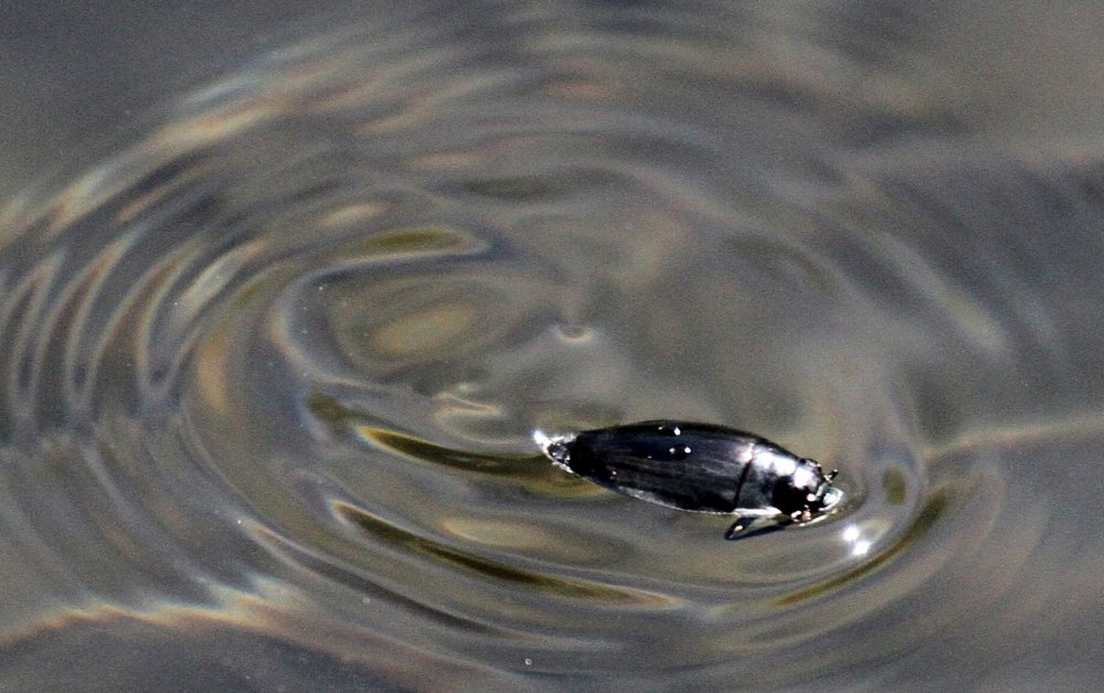
Whirligig Beetles are typically found in groups making crazy circles at the surface, although they are also capable of diving and flying. These are 'true beetles', not bugs. They are harmless scavengers.
-- Wikipedia
Note:
The rest of these bugs have a painful bite, like a wasp sting.
Water Scorpion
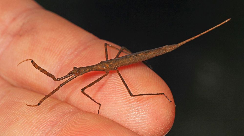
Above is the aptly-named Water Scorpion. These are generally found underwater in plant growth, although they fly very well, as do all waterbugs. If you are launching the boat through weeds, watch out for them, although you'd have to go out of your way to actually get bit.
-- Wikipedia
Water Boatman
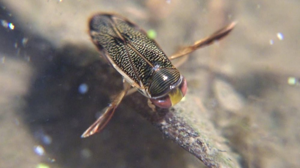
In my experience, Water Boatmen are the most common waterbugs - you can find them in almost any still waters. They swim right-side-up with enlarged back legs. Water Boatmen feed primarily on algea, and are unlikely to bite.
-- Wikipedia
Backswimmer
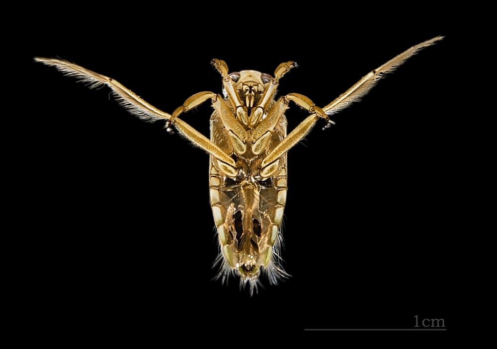
Backswimmers are similar to Water Boatmen, but swim upsidedown, as their name implies. They are predatory, and have a painful bite.
-- Wikipedia
Giant Water Bug
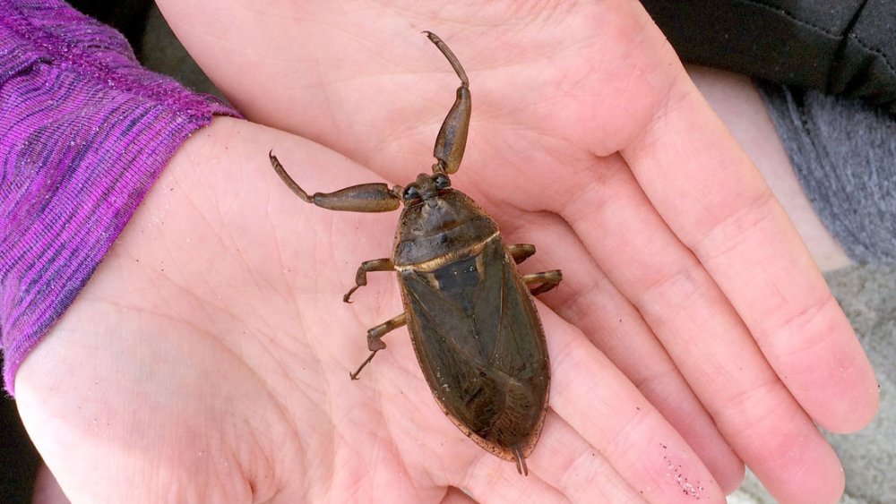
You are more likely to see a Giant Water Bug on your porch than out on the lake. This is because they are strong night fliers, and attracted to lights. Like all waterbugs, they can bite, and given the size of them - 'Giant' - I imagine they bite pretty good.
-- Wikipedia
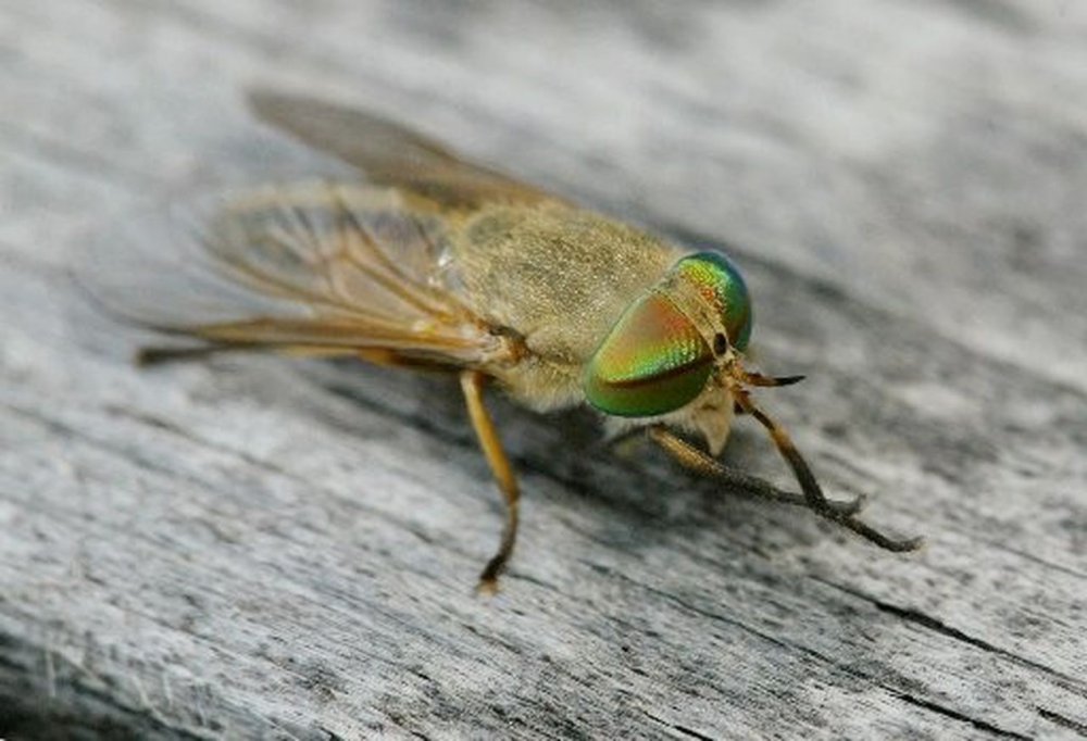
This is a listing of some of the tiny critters that you might find. I'm not including all the invisible biting nasties that you find around the water. That's what bug spray is for. Above is the horrible Greenhead fly - the bane of New Jersey summers. When one of these bites you, you know it.
More: Bugs ...
By Ronald M. Clayton
Illustrations by author
Maintaining an aquarium filled with local fish and other aquatics can be an enjoyable, learning experience, and give you a good excuse to get out and stomp around in your local pond or stream. It’s fun collecting new animals and plants to add to the aquarium, to replace ones that have died, or as food for your locally acquired fish, and learning about your wildlife is a fascinating part of the experience. In the shimmering shallows and mysterious depths of almost any nearby body of water thrives a whole world of living things, some very ugly and some very beautiful – the variety will amaze you. If you are interested in providing inexpensive recreation and education for yourself and perhaps your family, read on.
More: An Aquarium For the Naturalist ...