Raritan River
- Raritan River - Bound Brook ( 40.55995, -74.52758 )
- Raritan River - Branchburg ( 40.55644, -74.68838 )
- Raritan River - Duke Island (E) ( 40.56082, -74.64751 )
- Raritan River - Duke Island (W) ( 40.55279, -74.68330 )
- Raritan River - Edison ( 40.48791, -74.38382 )
- Raritan River - Highland Park ( 40.48864, -74.42226 )
- Raritan River - New Brunswick ( 40.48760, -74.43280 )
- Raritan River - Perth Amboy ( 40.50057, -74.27712 )
- Raritan River - Piscataway (N) ( 40.54085, -74.51236 )
- Raritan River - Piscataway (S) ( 40.50935, -74.46641 )
- Raritan River - Power Canal ( 40.55112, -74.67136 )
- Raritan River - Raritan ( 40.56492, -74.63884 )
- Raritan River - Sayreville ( 40.47450, -74.35606 )
- Raritan River - Somerville (E) ( 40.55798, -74.61520 )
- Raritan River - Somerville (W) ( 40.56539, -74.63173 )
- Raritan River North Branch ( 40.60018, -74.67447 )
- Raritan River North Branch - Far Hills ( 40.68441, -74.64214 )
- Raritan River North Branch - Natirar Park ( 40.64761, -74.68024 )
- Raritan River North Branch Depot ( 40.58160, -74.68161 )
- Raritan River South Branch ( 40.54640, -74.69603 )
- Raritan River South Branch - Clinton (N) ( 40.63854, -74.91169 )
- Raritan River South Branch - Clinton (S) ( 40.62806, -74.91200 )
- Raritan River South Branch - Flemington (C) ( 40.52105, -74.82666 )
- Raritan River South Branch - Flemington (E) ( 40.50354, -74.77814 )
- Raritan River South Branch - Flemington (N) ( 40.53810, -74.83934 )
- Raritan River South Branch - Hamden ( 40.59699, -74.89827 )
- Raritan River South Branch - High Bridge (N) ( 40.66394, -74.89742 )
- Raritan River South Branch - High Bridge (S) ( 40.66094, -74.90237 )
- Raritan River South Branch - Lockwood Gorge (N) ( 40.69682, -74.87171 )
- Raritan River South Branch - Lockwood Gorge (S) ( 40.68816, -74.88014 )
- Raritan River South Branch - Neshanic (E) ( 40.50873, -74.72776 )
- Raritan River South Branch - Neshanic (W) ( 40.50250, -74.74182 )
- Raritan River South Branch - Rte 31 ( 40.56315, -74.85544 )
- Raritan River South Branch - Stanton ( 40.57219, -74.86834 )
- Raritan River South Branch - Sunnyside ( 40.57942, -74.88795 )
The Raritan River is what is left of the outflow of the Hudson River after it broke through the Verrazano Narrows about 6,000 years ago and changed to its present course. The modern Raritan River drains much of central New Jersey, with tributaries threading through the state from Princeton to Morristown. One northern tributary - the Lamington River - reaches almost to Lake Hopatcong. Zoom the map out to see the entire drainage. The thin red line is the "fall line" - the nominal division between uplands and lowlands.
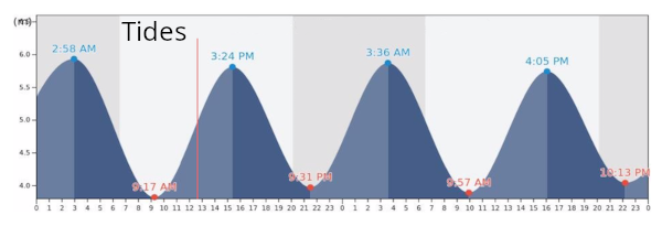
There is a nice free put-in in northern Piscataway. This spot has floating dock, and is convenient to Route 287. The river is tidal at this point, and the depth and flow will depend on that, and the season. If you go upstream from here, you may quickly run out of water! I made it to Bound Brook one day, but only by hiking through the ankle-deep riffles, towing the boat behind me. (Which is why you should always have a piece of rope with you. Ahem - line!)
If you look directly across the river from this spot, you can see why I recommended it - there is an excellent alternate five minutes away: the Delaware and Raritan Canal. The canal is always nice, no matter what state the river may be in.
If you scroll the map upstream, you can see a put-in in Bound Brook, but it is not too promising, as this spot places you between a dam and no water. The other side of the dam would be deeper water, but I have yet to find a good access for it - all railroad tracks along the bank, leading up to a weir.

It's deeper if you go the other way. If you scroll the map downstream, there are several more fairly convenient access points marked, from Piscataway to Edison. The river is pretty clean down past New Brunswick, but as you go further, it gets dirty and polluted. I wouldn't go past the Edison spot, in fact, I wouldn't even go that far.
The County boat ramps in Donaldson Park, Edison, and Sayreville require a permit. I don't know about the ramp in New Brunswick.
https://nynjbaykeeper.org/wp-content/uploads/2019/01/raritanriveraccess.pdf
Questions or Inquiries?
Just want to say Hello? Sign the .