
New Jersey has far more put-ins and places to explore than I can ever get to. If you've been somewhere good, or bad, click that contact link and send me a description. Or you can click the Support button and send a couple of bucks to help with the web hosting, software, and other costs - this stuff is not free!
( PayPal takes 3.49% + 49¢ per transaction )
More: Support NJKayak.net ...
A year ago, I drew-in a lot of waterways and borders because the available map styles just weren't suitable for the purpose here. Now I have created my own custom map style which emphasizes water features over roads and borders. Borders were especially tricky, since they are often those same water features I want to show. Maps aren't very useful without roads, so as you zoom in the roads details reappear.
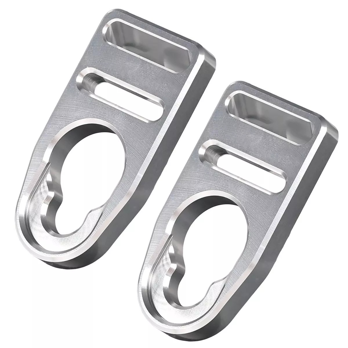
I recently installed these aluminum seat strap buckles. They are a direct replacement for the factory plastic buckles.
More: Seat Strap Buckles ...
After Google sent me a bill for their map service, I decided to switch to OpenLayers maps, which are free. And I quickly came to like them better. At first, I thought the satellite imagery was neat, but it turns out that often things are hidden under trees. Also, the coordinates on the satellite imagery are less-than-accurate. Google's street maps are also less-than-accurate, and also less-than-informative, lacking accurate borders and labels ( although they do have lots of advertising! )
As I got the hang of OpenLayers, I started to redo a lot of things and simplify, getting rid of a lot of stuff I had done to make up for the shortcomings of Google Maps. OpenLayers maps look a lot like USGS quadrangles, and don't need a lot of help, just zoom in and there is a wealth of information. Google's maps are also strongly colored, which makes it difficult at times to do anything with them. OpenLayers uses nice muted colors that are easy to write over.
More: New Maps ...
Here is every marker and line in the database, all at once on one map. What a mess - it took some careful design to avoid this. But I think the completely-obliterated map is funny, so I show it to you here. On the plus side, this is a good stress test, and performance is fine.
- Absecon Creek - Absecon ( 39.42635, -74.48653 )
- Alcyon Lake ( 39.72831, -75.14290 )
- Alloway Creek - Hancock's Bridge ( 39.50763, -75.46339 )
- Alloway Lake - Alloway ( 39.56288, -75.36070 )
- Ambrose Brook - Bound Brook ( 40.56764, -74.51489 )
- Ambrose Brook - Possumtown ( 40.55555, -74.48630 )
- Arthur Kill - Buckingham Ave ( 40.51462, -74.25871 )
- Arthur Kill - Carteret Waterfront ( 40.57186, -74.21301 )
- Arthur Kill - Ferry St ( 40.54576, -74.25424 )
- Assunpink Access ( 40.23568, -74.58683 )
- Assunpink Lake - Upper Freehold ( 40.21542, -74.51702 )
- Atsion Lake - Pinelands ( 39.73989, -74.73128 )
- Avis Millpond - Salem River ( 39.63089, -75.29061 )
- Bamber Lake - Lacey ( 39.89577, -74.31959 )
- Barnegat Bay - Barnegat ( 39.75401, -74.20171 )
- Barnegat Bay - Barnegat Light (N) ( 39.75763, -74.11138 )
- Barnegat Bay - Barnegat Light (S) ( 39.74500, -74.11764 )
- Barnegat Bay - Bay Harbor Park ( 40.01977, -74.12731 )
- Barnegat Bay - Brant Beach ( 39.61673, -74.20110 )
- Barnegat Bay - Bridge to Nowhere ( 39.68394, -74.20766 )
- Barnegat Bay - Harvey Cedars ( 39.70465, -74.13703 )
- Barnegat Bay - Island Beach SP ( 39.85222, -74.08899 )
- Barnegat Bay - Lavallette ( 39.96933, -74.07421 )
- Barnegat Bay - Mantoloking Bridge ( 40.04124, -74.05880 )
- Barnegat Bay - Oyster Creek ( 39.80873, -74.18455 )
- Barnegat Bay - Parkertown ( 39.60978, -74.29231 )
- Barnegat Bay - Seaside Heights ( 39.94524, -74.07956 )
- Barnegat Bay - Sedge Island ( 39.80786, -74.09599 )
- Barnegat Bay - Ship Bottom ( 39.65232, -74.18484 )
- Barnegat Bay - Tilton Point ( 39.96900, -74.11284 )
- Barnegat Bay - Tuckerton ( 39.57671, -74.33078 )
- Barnegat Bay - West Creek ( 39.63100, -74.29618 )
- Barnegat Bay - Woodville ( 39.98917, -74.13476 )
- Bass River - New Gretna ( 39.57721, -74.45079 )
- Batsto Lake - Batsto ( 39.64682, -74.65327 )
- Batsto River - Wharton State Forest ( 39.71014, -74.66747 )
- Bay Avenue - Ocean City ( 39.21643, -74.64678 )
- Bay Parkway - Lacey ( 39.80572, -74.17212 )
- Big Timber Creek - Fort Nassau ( 39.88024, -75.12680 )
- Big Timber Creek - Glendora (N) ( 39.85285, -75.09452 )
- Big Timber Creek - Glendora (S) ( 39.83769, -75.08264 )
- Blackwood Lake - Big Timber Creek ( 39.80194, -75.07405 )
- Bostwick Lake - Cohansey River ( 39.52842, -75.26801 )
- Brainerd Lake - Cranbury ( 40.31113, -74.51178 )
- Branch Brook Park ( 40.75077, -74.18305 )
- Buck's Pond - Colt's Neck ( 40.29178, -74.20380 )
- Budd Lake - Hackettstown ( 40.86292, -74.75154 )
- Bunker Hill Bogs - Jackson ( 40.08255, -74.29256 )
- Cedar Creek - Berkeley ( 39.90248, -74.24513 )
- Cedar Creek - Double Trouble ( 39.89402, -74.22495 )
- Cedar Creek - Lanoka Harbor ( 39.86936, -74.17065 )
- Cedar Creek - Stow Creek ( 39.44393, -75.40885 )
- Cedar Run - Stafford ( 39.64365, -74.24592 )
- Cedar Swamp Creek (N) ( 39.26195, -74.70206 )
- Cedar Swamp Creek (S) ( 39.24889, -74.71257 )
- Clinton Reservoir (N) ( 41.09734, -74.44232 )
- Clinton Reservoir (S) ( 41.09409, -74.44102 )
- Cohansey River - Bridgeton ( 39.42658, -75.23626 )
- Cohansey River - Dix WMA ( 39.37361, -75.29350 )
- Cohansey River - Ragged Island St. ( 39.36792, -75.35818 )
- Collier's Lake - New Egypt ( 40.06799, -74.44856 )
- Colonial Lake - Lawrence ( 40.25527, -74.72369 )
- Cooper River - Haddonfield ( 39.90090, -75.02056 )
- Cooper River Lake - Collingswood ( 39.92432, -75.07123 )
- Cooper River Park - Haddonfield ( 39.92561, -75.05672 )
- Country Lake - Pemberton ( 39.94530, -74.54257 )
- Cranberry Lake - Andover ( 40.95204, -74.73681 )
- Crosswick's Creek - Bordentown ( 40.14816, -74.71812 )
- Crosswick's Creek - Groveville ( 40.16705, -74.67717 )
- Crosswick's Creek - New Egypt (N) ( 40.08505, -74.54006 )
- Crosswick's Creek - New Egypt (S) ( 40.06679, -74.53226 )
- Crosswick's Creek - Walnford ( 40.13480, -74.55762 )
- D-R Canal - Amwell Rd ( 40.50340, -74.58268 )
- D-R Canal - Blackwells Mills ( 40.47550, -74.57220 )
- D-R Canal - Griggstown (N) ( 40.43834, -74.61397 )
- D-R Canal - Griggstown (S) ( 40.42912, -74.61816 )
- D-R Canal - Kingston (N) ( 40.37489, -74.61854 )
- D-R Canal - Kingston (S) ( 40.37326, -74.61861 )
- D-R Canal - Lawrence (N) ( 40.27450, -74.70332 )
- D-R Canal - Lawrence (S) ( 40.26746, -74.71071 )
- D-R Canal - Lawrenceville ( 40.30501, -74.68490 )
- D-R Canal - Manville ( 40.52861, -74.58178 )
- D-R Canal - New Brunswick ( 40.50806, -74.46376 )
- D-R Canal - North Trenton ( 40.24901, -74.72865 )
- D-R Canal - Plainsboro (E) ( 40.34321, -74.62964 )
- D-R Canal - Plainsboro (W) ( 40.34190, -74.63758 )
- D-R Canal - Princeton (N) ( 40.33879, -74.64715 )
- D-R Canal - Princeton (S) ( 40.33224, -74.65186 )
- D-R Canal - Province Line Rd ( 40.30273, -74.68819 )
- D-R Canal - Rocky Hill ( 40.39826, -74.62702 )
- D-R Canal - Somerset (N) ( 40.54077, -74.51404 )
- D-R Canal - Somerset (S) ( 40.52390, -74.49248 )
- D-R Canal - South Bound Brook ( 40.55880, -74.53118 )
- D-R Canal - Trenton (N) ( 40.23886, -74.74194 )
- D-R Canal - Trenton (S) ( 40.18384, -74.74666 )
- D-R Canal - West Windsor ( 40.30844, -74.67979 )
- D-R Feeder Canal - Bull Island ( 40.41036, -75.03421 )
- D-R Feeder Canal - Ewing ( 40.26529, -74.84790 )
- D-R Feeder Canal - Lambertville (S) ( 40.34206, -74.94044 )
- D-R Feeder Canal - Rt 202 ( 40.37987, -74.95175 )
- D-R Feeder Canal - Washington Crossing ( 40.29842, -74.86852 )
- D-R Feeder Canal - West Trenton ( 40.24497, -74.81917 )
- Dallenbach Pond ( 40.41254, -74.44296 )
- Davidson's Mill Pond - East Brunswick ( 40.41117, -74.49789 )
- Deal Lake - Asbury Park (N) ( 40.23759, -74.00784 )
- Deal Lake - Asbury Park (S) ( 40.22957, -74.00938 )
- Deep Run - Wharton State Forest ( 39.76288, -74.69219 )
- Deer Head Lake ( 39.85043, -74.21101 )
- Delaware Bay - East Point ( 39.19403, -75.02600 )
- Delaware Bay - Fortescue ( 39.22920, -75.16834 )
- Delaware Bay - Moore's Beach ( 39.18944, -74.95113 )
- Delaware Bay - Nantuxent Creek ( 39.28094, -75.24193 )
- Delaware Bay - New Sweden ( 39.29765, -75.24765 )
- Delaware Bay - Norbury's Landing ( 39.05033, -74.92742 )
- Delaware Bay - Sea Breeze ( 39.32315, -75.32094 )
- Delaware Bay - Sunset Beach ( 38.94432, -74.97012 )
- Delaware Bay - Thompson's Beach ( 39.19244, -74.99485 )
- Delaware Canal - Easton PA ( 40.68791, -75.20420 )
- Delaware Canal - Morrisville PA ( 40.21792, -74.77976 )
- Delaware Canal - New Hope ( 40.37983, -74.95835 )
- Delaware Canal - Newtown PA ( 40.26858, -74.86017 )
- Delaware Canal - Washington's X'ing PA ( 40.29014, -74.87709 )
- Delaware Canal - Yardley PA ( 40.23742, -74.82909 )
- Delaware River - Barnegat Lightship ( 39.95725, -75.11244 )
- Delaware River - Belvidere ( 40.82810, -75.08299 )
- Delaware River - Beverly ( 40.06894, -74.92243 )
- Delaware River - Burlington ( 40.08236, -74.85662 )
- Delaware River - Burlington ( 40.08192, -74.85063 )
- Delaware River - Byram ( 40.41550, -75.04780 )
- Delaware River - Caddo Access ( 41.31834, -74.79522 )
- Delaware River - Carney's Point ( 39.71737, -75.47630 )
- Delaware River - Dingman's Ferry PA ( 41.21942, -74.86017 )
- Delaware River - DR Trailhead ( 40.55255, -75.07909 )
- Delaware River - Easton PA ( 40.68995, -75.20448 )
- Delaware River - Elsinboro Point ( 39.54510, -75.52995 )
- Delaware River - Florence Twp ( 40.12238, -74.80412 )
- Delaware River - Fort Mott ( 39.60585, -75.55596 )
- Delaware River - Frenchtown ( 40.53633, -75.06492 )
- Delaware River - Kingwood ( 40.51265, -75.06306 )
- Delaware River - Kittatinny ( 40.96963, -75.12837 )
- Delaware River - Lambertville (N) ( 40.36072, -74.94531 )
- Delaware River - Lambertville (S) ( 40.34235, -74.94193 )
- Delaware River - Mad Horse ( 39.42123, -75.42695 )
- Delaware River - Miller Road ( 39.38263, -75.40641 )
- Delaware River - North Camden ( 39.95769, -75.11432 )
- Delaware River - Palmyra Cove ( 40.00916, -75.04176 )
- Delaware River - Paulsboro ( 39.84785, -75.25124 )
- Delaware River - Pennsauken ( 39.98092, -75.06567 )
- Delaware River - Pennsville ( 39.64836, -75.53254 )
- Delaware River - Philipsburg ( 40.69229, -75.20329 )
- Delaware River - Port Jervis NY ( 41.37715, -74.70473 )
- Delaware River - Portland PA ( 40.92351, -75.09649 )
- Delaware River - Poxono ( 41.04019, -75.02293 )
- Delaware River - Riegelsville ( 40.59222, -75.18845 )
- Delaware River - Rivergate ( 39.87718, -75.17961 )
- Delaware River - Riverside ( 40.03775, -74.97833 )
- Delaware River - Rockcores Trailhead ( 41.01750, -75.07020 )
- Delaware River - Titusville ( 40.30711, -74.88066 )
- Delaware River - Trenton ( 40.18662, -74.75351 )
- Delaware River - Turtle Beach ( 41.03352, -75.03776 )
- Delaware River - West Deptford ( 39.86198, -75.20709 )
- Delaware River - Worthington ( 41.00505, -75.10455 )
- Dennis Creek - Jake's Landing ( 39.17916, -74.85133 )
- Dick's Sporting Goods - West Windsor ( 40.30691, -74.67877 )
- DOD Ramp - Penns Grove ( 39.74873, -75.45564 )
- Dramasel/Pines Lake ( 39.81713, -75.04735 )
- East Amwell Lake ( 40.40023, -74.84316 )
- East Creek Pond - Dennis ( 39.22333, -74.88656 )
- East Lake - Salem River ( 39.64274, -75.31400 )
- Echo Lake - Mountainside ( 40.67351, -74.34560 )
- Etra Lake ( 40.25288, -74.49829 )
- Farrington Lake - East Brunswick (C) ( 40.42465, -74.47680 )
- Farrington Lake - East Brunswick (N) ( 40.43900, -74.46646 )
- Farrington Lake - East Brunswick (S) ( 40.42201, -74.48242 )
- Forge Pond - Brick ( 40.06646, -74.13446 )
- Franklinville Lake - Franklinville ( 39.61768, -75.07867 )
- Gibson's Creek ( 39.35592, -74.72609 )
- Great Bay - Graveling Point ( 39.53959, -74.38821 )
- Great Bay - Great Bay Blvd (N) ( 39.56316, -74.34202 )
- Great Bay - Great Bay Blvd (S) ( 39.52160, -74.31849 )
- Great Bay - Motts Creek ( 39.51826, -74.43637 )
- Great Bay - Rand's Marina ( 39.53934, -74.32614 )
- Great Egg Harbor Bay - Beerdley's Point ( 39.28756, -74.62664 )
- Great Egg Harbor Bay - Somers Point (N) ( 39.31130, -74.59272 )
- Great Egg Harbor Bay - Somers Point (S) ( 39.30640, -74.60763 )
- Great Egg Harbor River - Camp Acagisca ( 39.49275, -74.76715 )
- Great Egg Harbor River - Mays Landing ( 39.44940, -74.72489 )
- Great Egg Harbor River - New Brooklyn ( 39.70187, -74.93732 )
- Great Egg Harbor River - Penny Pot ( 39.57547, -74.82239 )
- Great Egg Harbor River - Piney Hollow Rd ( 39.62049, -74.89280 )
- Great Egg Harbor River - Weymouth ( 39.51339, -74.77889 )
- Green Brook - Billian Legion Park ( 40.56222, -74.52483 )
- Green Turtle Lake - West Milford ( 41.14896, -74.32896 )
- Greenwood Lake - Hewitt ( 41.15252, -74.34682 )
- Greenwood Lake - Warwick NY ( 41.21822, -74.29848 )
- Gropp Lake - White Horse ( 40.18761, -74.68888 )
- Grover's Mill Pond - Princeton Junction ( 40.31282, -74.60565 )
- Hackensack River - Bergenfield ( 40.92835, -74.03023 )
- Hackensack River - Foschini Park ( 40.88477, -74.03524 )
- Hackensack River - Meadowlands ( 40.80747, -74.05723 )
- Hackensack River - Secaucaus (S) ( 40.76390, -74.08685 )
- Hackensack River - Secaucus (N) ( 40.80552, -74.04345 )
- Hackensack River - USS Ling ( 40.87939, -74.04029 )
- Hammonton Lake ( 39.63010, -74.78734 )
- Harry Wright Lake ( 39.93076, -74.35880 )
- Helmetta Pond ( 40.37817, -74.42657 )
- Hester's Branch - Woodbury ( 39.83155, -75.14812 )
- Holiday Lake - Barnegat ( 39.73882, -74.26470 )
- Horicon Lake - Lakehurst ( 40.00720, -74.32177 )
- Hudson River - Fort Lee ( 40.85176, -73.95950 )
- Hudson River - Frying Pan Lightship ( 40.75215, -74.00927 )
- Hudson River - Hastings-on-Hudson NY ( 40.99739, -73.88466 )
- Hudson River - Inwood Hill Park NY ( 40.86947, -73.93208 )
- Hudson River - JFK Park Yonkers NY ( 40.95639, -73.89738 )
- Hudson River - Nyack NY (N) ( 41.11999, -73.91239 )
- Hudson River - Nyack NY (S) ( 41.08745, -73.91558 )
- Hudson River - Piermont NY ( 41.04248, -73.91583 )
- Hudson River - Winter Garden Lightship ( 40.70981, -74.04034 )
- Indian Mills Lake ( 39.79554, -74.73998 )
- Inside Thorofare - Atlantic City ( 39.35533, -74.45687 )
- Inside Thorofare - Ventnor ( 39.34593, -74.47623 )
- Island Beach SP Marina ( 39.90606, -74.08713 )
- Jenkins Sound - Mayville ( 39.06281, -74.81961 )
- Kirkwood Lake - Cooper River ( 39.83637, -75.00105 )
- Lake Absegami - Bass River ( 39.62529, -74.42760 )
- Lake Aeroflex - Andover ( 41.01041, -74.73564 )
- Lake Barnegat ( 39.84169, -74.20078 )
- Lake Carasaljo - Lakewood ( 40.09304, -74.22817 )
- Lake Carnegie - Plainsboro ( 40.34362, -74.62973 )
- Lake Carnegie - Princeton ( 40.36681, -74.62597 )
- Lake Denmark - Piccatinny (US Army) ( 40.96879, -74.51798 )
- Lake Hopatcong - Ashley's Cove ( 40.96426, -74.61082 )
- Lake Hopatcong - Hopatcong (E) ( 40.92890, -74.63861 )
- Lake Hopatcong - Hopatcong (W) ( 40.91763, -74.66346 )
- Lake Lefferts - Matawan ( 40.41563, -74.23362 )
- Lake Lenape - Mays Landing ( 39.46187, -74.73755 )
- Lake Luxembourg - Langhorne PA ( 40.20011, -74.91904 )
- Lake Manalapan - Jamesburg ( 40.34525, -74.43662 )
- Lake Musconetcong - Netcong ( 40.90099, -74.70354 )
- Lake Musconetcong - Port Morris Park ( 40.90851, -74.68505 )
- Lake Nockamixon - PA (C) ( 40.46634, -75.22454 )
- Lake Nockamixon - PA (N) ( 40.47655, -75.20949 )
- Lake Nockamixon - PA (S) ( 40.42520, -75.26002 )
- Lake Nummy - Belleplain ( 39.24691, -74.85720 )
- Lake Riviera - Brick ( 40.04590, -74.14573 )
- Lake Shenandoah - Lakewood ( 40.08845, -74.19941 )
- Lake Success - Jackson ( 40.05785, -74.39243 )
- Lake Surprise - Summit ( 40.69343, -74.37003 )
- Lake Topanemus - Freehold ( 40.27635, -74.28554 )
- Lake Weamaconk - Englishtown ( 40.29140, -74.35704 )
- Lakes Bay - Ventnor ( 39.35318, -74.48744 )
- Lamington/Black River - Ironia Rd ( 40.83520, -74.64481 )
- Lamington/Black River - Pleasant Hill Rd ( 40.80333, -74.69788 )
- Lamington/Black River - Pottersville ( 40.71374, -74.72011 )
- Lamington/Black River - Righter Rd ( 40.85089, -74.63450 )
- Lamington/Black River - Route 10 ( 40.86048, -74.62893 )
- Lamington/Black River - Washington Tpk. ( 40.77881, -74.72098 )
- Laurel Lake ( 39.81720, -75.01032 )
- Lawrence Brook - Milltown (E) ( 40.45144, -74.43663 )
- Lawrence Brook - Milltown (W) ( 40.44831, -74.44367 )
- Lebanon Lake - Pemberton ( 39.90686, -74.56550 )
- Lehigh Canal - Easton PA ( 40.66393, -75.23720 )
- Lehigh River - Bethleham PA ( 40.64488, -75.27186 )
- Lehigh River - Easton PA ( 40.68816, -75.20483 )
- Lehigh River - Easton PA (W) ( 40.67338, -75.23520 )
- Liberty State Park - Jersey City ( 40.69768, -74.06520 )
- Little Pine Lake - Pemberton ( 39.98857, -74.57096 )
- Long Reach - Avalon ( 39.08144, -74.73862 )
- Longport Dog Beach ( 39.30741, -74.55738 )
- Ludlam Thorofare - Sea Isle City ( 39.14373, -74.70499 )
- Makepeace Lake ( 39.54717, -74.75058 )
- Malaga Lake - Newfield ( 39.57878, -75.05643 )
- Manahawkin Lake - Stafford ( 39.69641, -74.26116 )
- Manasquan Reservoir - Howell ( 40.17217, -74.20300 )
- Manasquan River - Allaire ( 40.14376, -74.11673 )
- Manasquan River - Beverly Beach ( 40.10498, -74.09649 )
- Manasquan River - Brice Park ( 40.13764, -74.11038 )
- Manasquan River - Dog Beach ( 40.10623, -74.03785 )
- Manasquan River - Glimmer Glass ( 40.11653, -74.04946 )
- Manasquan River - Howell ( 40.17519, -74.16981 )
- Manasquan River - Ramshorn Drive ( 40.11961, -74.09418 )
- Manasquan River - Riverfront Park ( 40.08835, -74.07142 )
- Manasquan River - RR Bridge ( 40.10052, -74.04905 )
- Manasquan River - WMA ( 40.13689, -74.10431 )
- Mantua Creek - West Deptford ( 39.79546, -75.17112 )
- Marlu Lake - Lincroft ( 40.33463, -74.15354 )
- Maurice River - Alliance Beach ( 39.50198, -75.07976 )
- Maurice River - Garden Road ( 39.52199, -75.07329 )
- Maurice River - Mauricetown ( 39.28730, -74.98763 )
- Maurice River - Milleville ( 39.37706, -75.03671 )
- Maurice River - Sharp St ( 39.40012, -75.05345 )
- Maurice River - Terrapin Cove ( 39.24547, -75.00404 )
- Maurice River - West Side Park ( 39.49608, -75.07611 )
- Maurice River - Willow Grove ( 39.54996, -75.07146 )
- Mercer Lake - Hamilton ( 40.26561, -74.64191 )
- Mercer Lake - West Windsor ( 40.26960, -74.64114 )
- Merrill Creek Reservoir - Harmony ( 40.73871, -75.09092 )
- Metedeconk River - Bay Ave ( 40.06602, -74.05130 )
- Metedeconk River - Bay Blvd ( 40.06288, -74.05502 )
- Metedeconk River - Bennett's Pond ( 40.13058, -74.28406 )
- Metedeconk River - Brick ( 40.05687, -74.11203 )
- Metedeconk River - Dock Rd ( 40.05055, -74.11413 )
- Metedeconk River - Sandy Point ( 40.05129, -74.07785 )
- Mill Pond - Princeton Meadows (E) ( 40.32460, -74.56567 )
- Mill Pond - Princeton Meadows (W) ( 40.32735, -74.60233 )
- Miller Creek ( 39.25262, -74.62715 )
- Millhurst Pond - Freehold ( 40.24590, -74.34066 )
- Millstone River - Blackwells Mills ( 40.47487, -74.57503 )
- Millstone River - Cranbury (E) ( 40.29359, -74.52675 )
- Millstone River - Cranbury (W) ( 40.29590, -74.56250 )
- Millstone River - Griggstown ( 40.43898, -74.61783 )
- Millstone River - Kingston ( 40.37419, -74.61962 )
- Millstone River - Manville ( 40.53124, -74.58753 )
- Millstone River - Plainsboro (N) ( 40.34262, -74.62981 )
- Millstone River - Plainsboro (S) ( 40.33874, -74.62880 )
- Millstone River - weir ( 40.43915, -74.61787 )
- Millstone River - West Windsor ( 40.32139, -74.60831 )
- Mirror Lake - Pemberton (N) ( 39.97209, -74.56941 )
- Mirror Lake - Pemberton (S) ( 39.96729, -74.57847 )
- Miry Run ( 40.24052, -74.64696 )
- Monksville Reservoir - West Milford (N) ( 41.14241, -74.30055 )
- Monksville Reservoir - West Milford (S) ( 41.12695, -74.30127 )
- Monksville Reservoir - West Milford (W) ( 41.13686, -74.30684 )
- Morris Canal - Waterloo ( 40.91259, -74.76785 )
- Mountain Lake - Denville ( 40.88952, -74.44225 )
- Mullica River - Batsto ( 39.63973, -74.65889 )
- Mullica River - Crowley Landing ( 39.62640, -74.61922 )
- Mullica River - Hay Road Beach ( 39.57349, -74.53943 )
- Musconetcong River - Asbury ( 40.69541, -75.01000 )
- Musconetcong River - Beattystown (N) ( 40.82340, -74.83263 )
- Musconetcong River - Beattystown (S) ( 40.81291, -74.84166 )
- Musconetcong River - Bethlehem ( 40.70445, -74.98786 )
- Musconetcong River - Bloomsbury ( 40.65918, -75.08058 )
- Musconetcong River - Changewater ( 40.73889, -74.94140 )
- Musconetcong River - Hackettstown ( 40.83466, -74.82278 )
- Musconetcong River - Hampton Park ( 40.71115, -74.96795 )
- Musconetcong River - Hughesville ( 40.61851, -75.15887 )
- Musconetcong River - Saxton ( 40.88829, -74.79732 )
- Musconetcong River - Stephens SP ( 40.87225, -74.80619 )
- Musconetcong River - Waterloo (N) ( 40.91147, -74.76912 )
- Musconetcong River - Waterloo (S) ( 40.89663, -74.79111 )
- Musconetcong River - WMA ( 40.80501, -74.85012 )
- Nacote Creek - Port Republic ( 39.51768, -74.49363 )
- Navesink River - Fair Haven ( 40.36647, -74.04204 )
- Navesink River - Red Bank ( 40.35212, -74.06980 )
- Navesink River - Rumson (E) ( 40.37649, -73.99990 )
- Navesink River - Rumson (W) ( 40.37650, -74.01310 )
- Neshaminy Creek - Newtown PA ( 40.23271, -74.97409 )
- Neversink River - Port Jervis NY ( 41.37589, -74.67546 )
- New Brunswick Water Utility ( 40.48340, -74.41271 )
- New Market Pond - Piscataway ( 40.57675, -74.45490 )
- Newark Bay - Bayonne ( 40.66284, -74.13305 )
- Newark Bay - Rutkowski Park ( 40.68882, -74.11216 )
- Newton Creek - Johnson Park ( 39.89464, -75.11321 )
- Newton Lake - Collingswood ( 39.90840, -75.08179 )
- Old Place Creek, Staten Island ( 40.62721, -74.18237 )
- Oldman's Creek - Bridgeport ( 39.78437, -75.40694 )
- Oldman's Creek - Harrisonville ( 39.68277, -75.26706 )
- Oldman's Creek - Swedesboro ( 39.74857, -75.37972 )
- Orange Reservoir - Rahway River ( 40.75964, -74.28903 )
- Oswego Lake - Penn State Forest ( 39.73454, -74.49111 )
- Oswego River - Martha Bridge ( 39.68159, -74.51416 )
- Overpeck Creek - Teaneck ( 40.86648, -74.00077 )
- Oxford Furnace Lake - Oxford ( 40.79468, -75.01217 )
- Oyster Creek ( 39.80866, -74.18460 )
- Parvin Lake - Pittsgrove ( 39.50613, -75.12979 )
- Passaic River - Basking Ridge ( 40.69503, -74.51600 )
- Passaic River - Chatham ( 40.73795, -74.37159 )
- Passaic River - Chatham ( 40.72583, -74.38948 )
- Passaic River - Dead River ( 40.65005, -74.52464 )
- Passaic River - East Hanover (N) ( 40.82749, -74.33529 )
- Passaic River - East Hanover (S) ( 40.82581, -74.33332 )
- Passaic River - Elmwood Park ( 40.90965, -74.13188 )
- Passaic River - Fairfield ( 40.89775, -74.27988 )
- Passaic River - Hawthorne ( 40.93992, -74.15224 )
- Passaic River - Kearny ( 40.76313, -74.15933 )
- Passaic River - Livingston ( 40.77879, -74.36862 )
- Passaic River - Memorial Park ( 40.92865, -74.14193 )
- Passaic River - Newark ( 40.73326, -74.15206 )
- Passaic River - Nutley ( 40.81175, -74.13909 )
- Passaic River - Passaic ( 40.86506, -74.11144 )
- Passaic River - Riverside County Park (N) ( 40.81865, -74.13348 )
- Passaic River - Riverside County Park (S) ( 40.80182, -74.13801 )
- Passaic River - Rutherford ( 40.82349, -74.12280 )
- Passaic River - Veteran's Park ( 40.85042, -74.11898 )
- Passaic River - Warren ( 40.67078, -74.46441 )
- Patcong Creek - Bargaintown Pond ( 39.36083, -74.57569 )
- Patcong Creek - Belhaven ( 39.34363, -74.58752 )
- Patcong Creek - New Road ( 39.30470, -74.62031 )
- Paulins Kill - access ( 41.07478, -74.78607 )
- Paulins Kill - Blairstown ( 40.97758, -74.94390 )
- Paulins Kill - Brugler Road ( 40.93581, -75.07082 )
- Paulins Kill - Columbia ( 40.92181, -75.08838 )
- Paulins Kill - Footbridge Park ( 40.98121, -74.95964 )
- Paulins Kill - Stillwater ( 41.03284, -74.87420 )
- Paulins Kill Lake - Newton ( 41.05273, -74.82674 )
- Peace Valley Reservoir - Doylestown PA ( 40.31968, -75.19438 )
- Peaquannock River - Appelt Park ( 41.00189, -74.31640 )
- Peaquannock River - Oak Ridge Reservoir ( 41.06314, -74.48597 )
- Peaquannock River - Riverdale ( 40.99137, -74.29694 )
- Peaquannock River - Riverdale Rd ( 40.98818, -74.29319 )
- Peckman River - Cedar Grove ( 40.85861, -74.22711 )
- Peddie Lake - Hightstown ( 40.26870, -74.52219 )
- Pennsauken Creek - Cinnaminson (E) ( 39.97961, -75.00867 )
- Pennsauken Creek - Cinnaminson (W) ( 39.98056, -75.01119 )
- Pequest River - Allamuchy ( 40.92160, -74.84089 )
- Pequest River - Belvidere (E) ( 40.83055, -75.06737 )
- Pequest River - Belvidere (W) ( 40.83097, -75.07068 )
- Pequest River - Bridgeville ( 40.83408, -75.02735 )
- Pequest River - Hackettstown ( 40.86630, -74.90540 )
- Pequest River - Pequest ( 40.83722, -74.95327 )
- Perrineville Lake ( 40.22667, -74.43784 )
- Pine Lake ( 40.00910, -74.24948 )
- Pines Lake - Pompton ( 40.98952, -74.26212 )
- Pompton River - Follari Tract ( 40.98011, -74.29032 )
- Pompton River - Lincoln Park ( 40.91475, -74.27182 )
- Pompton River - River Drive ( 40.98153, -74.29748 )
- Potash Lake - Ramapo River ( 41.02250, -74.25936 )
- Presidential Lakes - Pemberton ( 39.91110, -74.57680 )
- Prospertown Lake - Jackson ( 40.13497, -74.45779 )
- Raccoon Creek - Bridgeport ( 39.80121, -75.35517 )
- Raccoon Creek - Mullica Hill ( 39.73444, -75.22043 )
- Rahway River - Clark ( 40.62884, -74.29746 )
- Rahway River - Cranford (N) ( 40.66036, -74.30627 )
- Rahway River - Cranford (S) ( 40.65097, -74.30133 )
- Rahway River - Cranford (W) ( 40.65900, -74.30997 )
- Rahway River - Jackson's Pond ( 40.62805, -74.28492 )
- Rahway River - Lenape Park ( 40.67407, -74.31426 )
- Rahway River - Mohawk Park ( 40.64041, -74.29408 )
- Rahway River - Nomahegan Lake ( 40.66832, -74.31741 )
- Rahway River - Park ( 40.62040, -74.28944 )
- Rahway River - Rahway ( 40.59952, -74.26856 )
- Rahway River - South Branch (E) ( 40.60010, -74.27397 )
- Rahway River - South Branch (W) ( 40.57998, -74.30463 )
- Rahway River - South Mountain ( 40.73112, -74.30704 )
- Rahway River - Springfield ( 40.70824, -74.30186 )
- Rainbow Lake - Pittsgrove ( 39.48757, -75.11186 )
- Ramapo River - Glen Gray Rd ( 41.05339, -74.22408 )
- Ramapo River - Great Oak Park ( 41.01630, -74.26106 )
- Ramapo River - Halifax Rd ( 41.08543, -74.18332 )
- Ramapo River - Pompton Lake (E) ( 41.00056, -74.27621 )
- Ramapo River - Pompton Lake (N) ( 41.00602, -74.27796 )
- Ramapo River - Pompton Lake (W) ( 41.00392, -74.28272 )
- Ramapo River - Ramapo Reservation ( 41.07835, -74.18937 )
- Ramapo River - Stiles Park ( 40.98695, -74.28014 )
- Ramapo River - West Mahwah ( 41.10486, -74.15591 )
- Rancocas Creek - Birmingham ( 39.97927, -74.70974 )
- Rancocas Creek - Hainesport ( 39.98489, -74.84372 )
- Rancocas Creek - Lumberton ( 39.96856, -74.81406 )
- Rancocas Creek - Medford Park ( 39.89713, -74.82061 )
- Rancocas Creek - Mt Holly (E) ( 39.99028, -74.77972 )
- Rancocas Creek - Mt Holly (W) ( 39.98980, -74.78956 )
- Rancocas Creek - New Lisbon ( 39.96205, -74.64102 )
- Rancocas Creek - Pemberton (E) ( 39.96746, -74.58789 )
- Rancocas Creek - Pemberton (W) ( 39.97030, -74.68377 )
- Rancocas Creek - Pemberton Heights ( 39.96244, -74.65567 )
- Rancocas Creek - Smithville ( 39.98571, -74.75083 )
- Rancocas Creek - Willingboro ( 40.02992, -74.92946 )
- Raritan Bay - Atlantic Highlands ( 40.41858, -74.04652 )
- Raritan Bay - Cliffwood (E) ( 40.45089, -74.22033 )
- Raritan Bay - Cliffwood (W) ( 40.45216, -74.22269 )
- Raritan Bay - Cliffwood (Whale Creek) ( 40.45090, -74.22274 )
- Raritan Bay - Highlands ( 40.40340, -73.98494 )
- Raritan Bay - Keyport (E) ( 40.44095, -74.19534 )
- Raritan Bay - Keyport (W) ( 40.43921, -74.20160 )
- Raritan Bay - Laurence Harbor (E) ( 40.45877, -74.24622 )
- Raritan Bay - Laurence Harbor (W) ( 40.46223, -74.25482 )
- Raritan Bay - Leonardo ( 40.42375, -74.06122 )
- Raritan Bay - Middletown ( 40.44463, -74.11175 )
- Raritan Bay - Port Monmouth ( 40.43800, -74.08955 )
- Raritan Bay - Sandy Hook ( 40.41555, -73.98161 )
- Raritan Bay - South Amboy (N) ( 40.48343, -74.27059 )
- Raritan Bay - South Amboy (S) ( 40.47946, -74.26831 )
- Raritan Bay - South Amboy Ramp ( 40.48401, -74.27416 )
- Raritan Bay - Union Beach (E) ( 40.44787, -74.16598 )
- Raritan Bay - Union Beach (W) ( 40.45479, -74.17517 )
- Raritan River - Bound Brook ( 40.55995, -74.52758 )
- Raritan River - Branchburg ( 40.55644, -74.68838 )
- Raritan River - Duke Island (E) ( 40.56082, -74.64751 )
- Raritan River - Duke Island (W) ( 40.55279, -74.68330 )
- Raritan River - Edison ( 40.48791, -74.38382 )
- Raritan River - Highland Park ( 40.48864, -74.42226 )
- Raritan River - New Brunswick ( 40.48760, -74.43280 )
- Raritan River - Perth Amboy ( 40.50057, -74.27712 )
- Raritan River - Piscataway (N) ( 40.54085, -74.51236 )
- Raritan River - Piscataway (S) ( 40.50935, -74.46641 )
- Raritan River - Power Canal ( 40.55112, -74.67136 )
- Raritan River - Raritan ( 40.56492, -74.63884 )
- Raritan River - Sayreville ( 40.47450, -74.35606 )
- Raritan River - Somerville (E) ( 40.55798, -74.61520 )
- Raritan River - Somerville (W) ( 40.56539, -74.63173 )
- Raritan River North Branch ( 40.60018, -74.67447 )
- Raritan River North Branch - Far Hills ( 40.68441, -74.64214 )
- Raritan River North Branch - Natirar Park ( 40.64761, -74.68024 )
- Raritan River North Branch Depot ( 40.58160, -74.68161 )
- Raritan River South Branch ( 40.54640, -74.69603 )
- Raritan River South Branch - Clinton (N) ( 40.63854, -74.91169 )
- Raritan River South Branch - Clinton (S) ( 40.62806, -74.91200 )
- Raritan River South Branch - Flemington (C) ( 40.52105, -74.82666 )
- Raritan River South Branch - Flemington (E) ( 40.50354, -74.77814 )
- Raritan River South Branch - Flemington (N) ( 40.53810, -74.83934 )
- Raritan River South Branch - Hamden ( 40.59699, -74.89827 )
- Raritan River South Branch - High Bridge (N) ( 40.66394, -74.89742 )
- Raritan River South Branch - High Bridge (S) ( 40.66094, -74.90237 )
- Raritan River South Branch - Lockwood Gorge (N) ( 40.69682, -74.87171 )
- Raritan River South Branch - Lockwood Gorge (S) ( 40.68816, -74.88014 )
- Raritan River South Branch - Neshanic (E) ( 40.50873, -74.72776 )
- Raritan River South Branch - Neshanic (W) ( 40.50250, -74.74182 )
- Raritan River South Branch - Rte 31 ( 40.56315, -74.85544 )
- Raritan River South Branch - Stanton ( 40.57219, -74.86834 )
- Raritan River South Branch - Sunnyside ( 40.57942, -74.88795 )
- Reeds Bay - Absecon ( 39.44306, -74.46194 )
- Repaupo Creek - Logan Twp ( 39.82960, -75.33016 )
- Rising Sun Lake - Upper Freehold ( 40.20699, -74.46339 )
- Robbins Reef Lighthouse ( 40.65736, -74.06536 )
- Robinson's Branch - Rahway River ( 40.61839, -74.30495 )
- Rockaway River - Boonton ( 40.91556, -74.42705 )
- Rockaway River - Denville (E) ( 40.89625, -74.47500 )
- Rockaway River - Denville (W) ( 40.89916, -74.48675 )
- Rockaway River - McCarter Park ( 40.89122, -74.47349 )
- Rockaway River - Montville ( 40.89893, -74.37344 )
- Rockaway River - Pine Brook ( 40.86608, -74.35202 )
- Rockaway River - Rockaway (E) ( 40.90190, -74.50881 )
- Rockaway River - Rockaway (W) ( 40.89737, -74.51528 )
- Rockaway River - Towpath Rd ( 40.90322, -74.46364 )
- Rockaway River - Wharton ( 40.88947, -74.56952 )
- Rockaway River - WMA ( 40.95537, -74.57069 )
- Rockland Lake - Nayak NY ( 41.14291, -73.92742 )
- Rocky Brook - Hightstown ( 40.27108, -74.52353 )
- Round Valley Reservoir - Clinton (N) ( 40.63204, -74.84726 )
- Round Valley Reservoir - Clinton (S) ( 40.61800, -74.84664 )
- Saddle River - County Park ( 40.97559, -74.09215 )
- Saddle River - County Park (N) ( 40.91908, -74.08952 )
- Saddle River - County Park (S) ( 40.91051, -74.08955 )
- Saddle River - Dunkerhook ( 40.94610, -74.09835 )
- Saddle River - Lodi ( 40.88361, -74.08428 )
- Saddle River - Saddle River ( 41.03307, -74.10117 )
- Salem River - Mannington ( 39.66957, -75.46619 )
- Salem River - Salem ( 39.57881, -75.46628 )
- Salem River - Supawna NWR ( 39.56956, -75.49853 )
- Salem River - Woodstown ( 39.64486, -75.32774 )
- Salem River WMA - Pennsville ( 39.64026, -75.48012 )
- Scull Bay - Bridge Out ( 39.34668, -74.55683 )
- Shadow Lake - Middletown ( 40.34698, -74.10476 )
- Shark River - Belmar ( 40.17946, -74.03743 )
- Shark River - Neptune ( 40.19364, -74.03092 )
- Shark River - Wall Township ( 40.19149, -74.05792 )
- Shaw's Mill Pond - Newton ( 39.31290, -75.15645 )
- Shepherd Pond - Ringwood ( 41.13571, -74.23189 )
- Shrewsbury River - Blackberry Park ( 40.32556, -74.00672 )
- Shrewsbury River - Branchport ( 40.31165, -74.00316 )
- Shrewsbury River - Fort Monmouth ( 40.32337, -74.03355 )
- Shrewsbury River - Galilee ( 40.34273, -73.97625 )
- Shrewsbury River - Long Branch ( 40.32594, -73.99006 )
- Shrewsbury River - Monmouth Beach ( 40.32805, -73.98631 )
- Shrewsbury River - North Rd ( 40.33662, -73.98315 )
- Shrewsbury River - Oceanport Creek ( 40.31460, -74.02877 )
- Shrewsbury River - Rumson ( 40.35672, -73.98569 )
- Shrewsbury River - Sea Bright (E) ( 40.36542, -73.97673 )
- Shrewsbury River - Sea Bright (W) ( 40.36263, -73.98172 )
- Shrewsbury River - Seawaneka Ave ( 40.33023, -74.00426 )
- Shrewsbury River - Somers Scout Park ( 40.33016, -74.00132 )
- Silver Lake - Hope ( 40.93370, -74.94996 )
- Somers Bay - Brigantine ( 39.40916, -74.36937 )
- South River - Old Bridge ( 40.41228, -74.36362 )
- South River - Sayreville ( 40.45397, -74.37222 )
- South River - South River ( 40.45838, -74.38361 )
- Speedwell Lake - Morristown ( 40.81265, -74.48090 )
- Split Rock Reservoir - Rockaway ( 40.96274, -74.45808 )
- Spring Lake ( 40.19512, -74.73217 )
- Spruce Run Reservoir - Clinton (C) ( 40.66109, -74.92356 )
- Spruce Run Reservoir - Clinton (E) ( 40.64468, -74.92302 )
- Spruce Run Reservoir - Clinton (N) ( 40.67351, -74.91731 )
- Spruce Run Reservoir - Clinton (S) ( 40.65841, -74.93343 )
- Stafford Forge WMA - Manahawkin ( 39.66881, -74.32090 )
- Steeny Kill Lake - High Point ( 41.32085, -74.67720 )
- Stephen Creek ( 39.38564, -74.73649 )
- Stephen Creek - Maple Lake ( 39.40547, -74.77808 )
- Stephen Creek - Stephen Lake ( 39.39556, -74.74907 )
- Stewart Lake - Woodbury ( 39.84193, -75.14283 )
- Stockton Lake - Manasquan ( 40.11739, -74.03460 )
- Stone Tavern Lake - Upper Freehold ( 40.19587, -74.48596 )
- Stony Brook - Pennington ( 40.33257, -74.75809 )
- Stony Brook - Princeton ( 40.33219, -74.65340 )
- Stony Brook - Rosedale ( 40.33168, -74.77828 )
- Strathmere Bay - Strathmere ( 39.19447, -74.66326 )
- Strawberry Lake - Moorestown ( 39.95460, -74.94940 )
- Sunken Branch - Toms River ( 39.96792, -74.24211 )
- Sunset Lake ( 40.87071, -74.61751 )
- Sunset Lake - Cohansey River ( 39.44637, -75.23975 )
- Swartswood Lake - Newton (N) ( 41.07356, -74.82440 )
- Swartswood Lake - Newton (S) ( 41.06296, -74.85278 )
- Swimming River - Middletown ( 40.34831, -74.08318 )
- Swimming River - Red Bank ( 40.33838, -74.08815 )
- Tennessee Ave - Ocean City ( 39.27051, -74.60393 )
- Thundergust Lake ( 39.50277, -75.13396 )
- Tilcon Lake - Waterloo ( 40.90717, -74.76840 )
- Timber Creek ( 39.83638, -75.05988 )
- Toms River - Beachwood ( 39.94250, -74.18446 )
- Toms River - Cranmoor Manor ( 39.94859, -74.16332 )
- Toms River - Gilford Park ( 39.94262, -74.13393 )
- Toms River - Huddy Park ( 39.95082, -74.19782 )
- Toms River - Oceangate Beach ( 39.92840, -74.13547 )
- Toms River - Pine Beach ( 39.93789, -74.15776 )
- Toms River - Pine Lake Park ( 40.00353, -74.24106 )
- Toms River - Pocket Park ( 39.94102, -74.17354 )
- Toms River - Rt 527 ( 39.98639, -74.22380 )
- Toms River - Water St ( 39.95171, -74.19990 )
- Toms River - Winding River Park (N) ( 39.98350, -74.22255 )
- Toms River - Winding River Park (S) ( 39.96802, -74.21393 )
- Toms River - Windsor Park ( 39.94676, -74.15658 )
- Tuckahoe River - Corbin City ( 39.29883, -74.75319 )
- Tuckahoe River - Tuckahoe ( 39.29545, -74.74010 )
- Turkey Swamp Park - Freehold ( 40.19577, -74.30435 )
- Turn Mill Pond - New Egypt ( 40.06371, -74.44772 )
- Twilight Lake - Bay Head ( 40.07474, -74.04404 )
- Union Lake - Millville (E) ( 39.40677, -75.05152 )
- Union Lake - Millville (W) ( 39.40812, -75.06712 )
- Verona Lake - Montclair ( 40.82705, -74.24588 )
- Wading River - Beaver Branch ( 39.65059, -74.51890 )
- Wading River - Bodine Field Road ( 39.65401, -74.52497 )
- Wading River - Evans Bridge ( 39.67517, -74.54066 )
- Wading River - Godfrey Bridge ( 39.68987, -74.54612 )
- Wading River - Harrisville Pond ( 39.66547, -74.52434 )
- Wading River - Hawkins Bridge ( 39.71442, -74.56595 )
- Wagner's Marina - Matawan Creek ( 40.43540, -74.21416 )
- Walkill River - Bassetts Bridge ( 41.26008, -74.55100 )
- Walkill River - Franklin ( 41.11063, -74.58840 )
- Walkill River - Glenwood Rd ( 41.19413, -74.57499 )
- Walkill River - Hamburg ( 41.15266, -74.58161 )
- Walkill River - Unionville NY ( 41.28789, -74.53406 )
- Wanaque River - Back Beach Park ( 41.03504, -74.28571 )
- Wanaque River - Hershfield Park ( 40.99313, -74.28983 )
- Watchung Lake - North Plainfield ( 40.63723, -74.45384 )
- Wawayanda Lake - Wawayanda SP ( 41.18823, -74.42609 )
- Weequahic Lake - Newark ( 40.70570, -74.19775 )
- Wells Mills Pond ( 39.79387, -74.27701 )
- Weston's Mill Pond - East Brunswick ( 40.46677, -74.42603 )
- Whippany River - Whippany ( 40.81921, -74.44021 )
- White Lake - Freylinghausen ( 41.00076, -74.91654 )
- White's Pond - Waldwick ( 41.01724, -74.13142 )
- Whitesbog - Pemberton ( 39.96504, -74.48711 )
- Wilson Lake - Glassboro ( 39.65715, -75.05088 )
- Woodbridge Creek (N) ( 40.58555, -74.26267 )
- Woodbridge Creek (S) ( 40.56256, -74.26890 )
- Woodbury Creek - West Deptford ( 39.84158, -75.15443 )
- Woodcliff Lake - Hillsdale ( 41.02150, -74.04133 )
- Wreck Pond - Sea Girt ( 40.13880, -74.02726 )
- Wreck Pond - Spring Lake ( 40.14107, -74.04003 )
Along with that mess, above is a custom marker listing that I wrote. Unlike the map plugin lists, mine is generated by the server, so it is not invisible to the search engines. In this case, it is pulling every marker in the database. A bit of server-side caching cleverness, and the processing cost is near nothing.
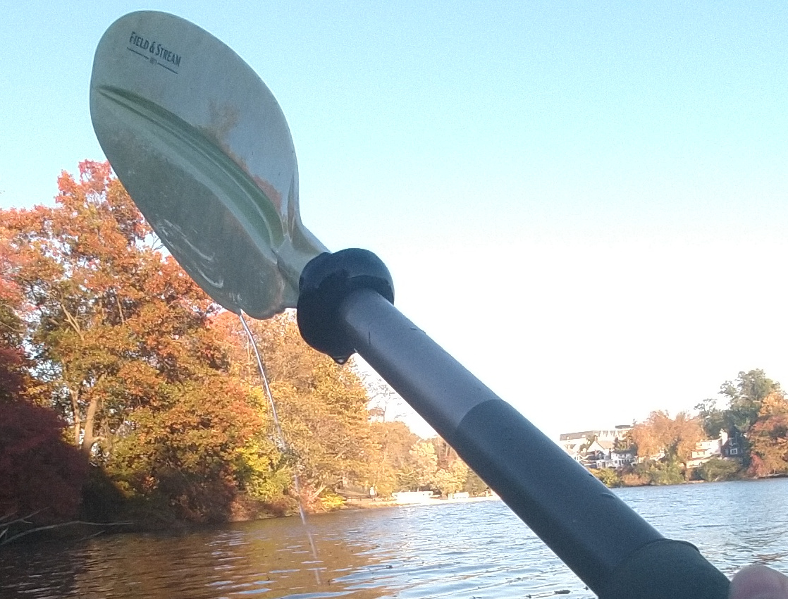
This paddle is nearing the end of its life, so I decided to try an experiment. I added a "drip notch". This is a small sharp-edged notch that the water flow can't follow. Instead it departs the edge of the paddle and falls well outside the boat. I hardly got a drop of water on me.
To make the notch, simply drill a 1/4" hole by the edge of the plastic blade, 6-7 inches from the base. Then file it to the shape you see here, with a sharp corner at the edge. The back-cut assures the the stream can't jump over the notch to the other side.
I can't claim this idea, I've seen a few paddles with this feature.
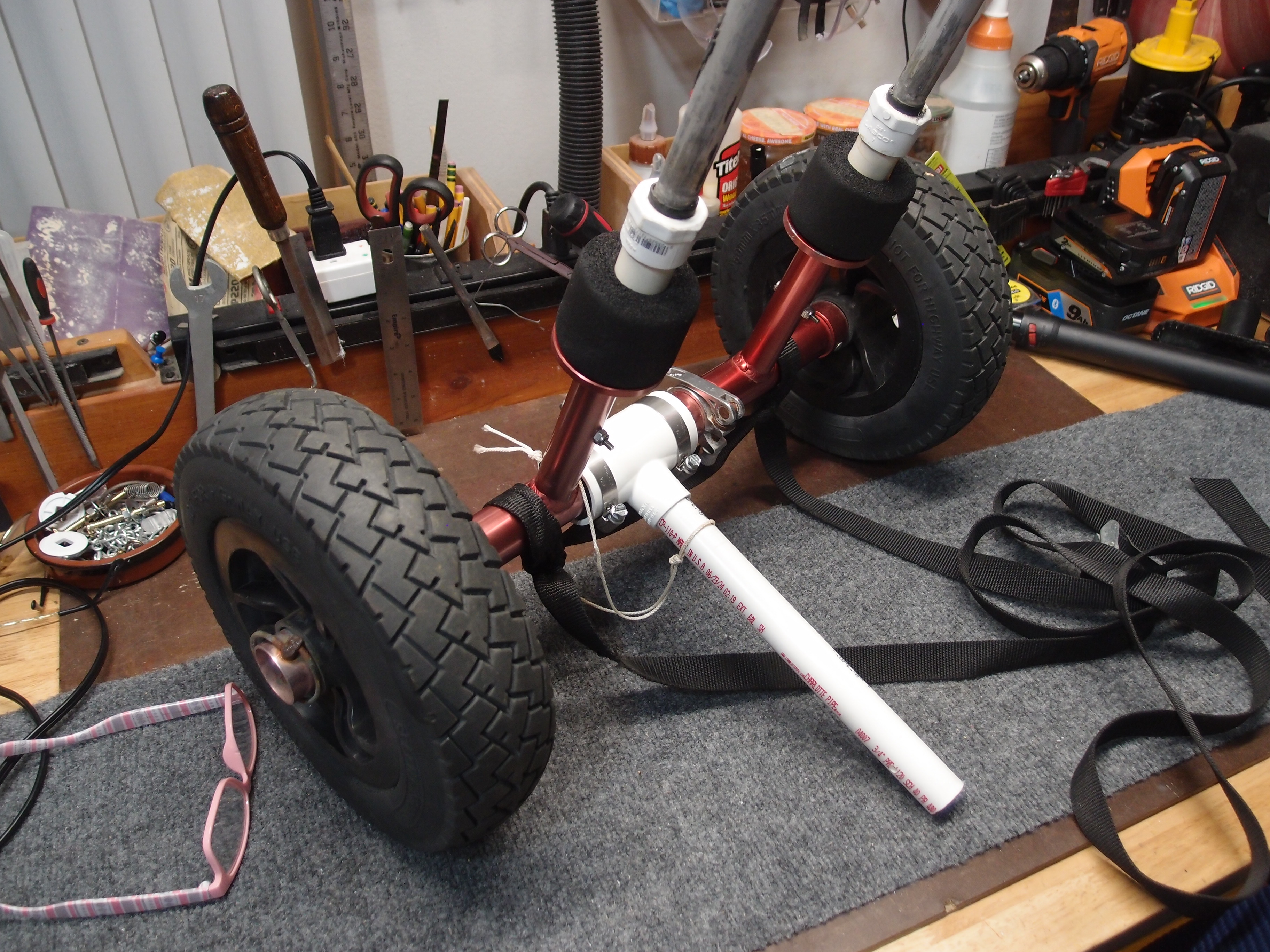
The problem with scupper carts is that they always seem to need a third hand to set up, and that hand is usually attached to someone else, in which case you don't really need a scupper cart, do you? Newer models have a built-in kickstand that looks so useful, it got me thinking. For twelve dollar's worth of plumbing parts at Home Depot, I made this.
More: Clever Me ...
All maps are now snapshots of one master map. You can now navigate the website by zooming, dragging, and clicking on the maps.
Then I went nuts, and added a ton of markers for things that look promising on Google Earth. Now it's a bigger mess than it ever was.
I also figured out how to draw the county borders on the maps.
The Google Maps API leaves much to be desired. In fact, the whole thing reeks of typical Google arrogance and stupidity. After messing around with it a while, finding out what doesn't work and what you can do, I eventually cobbled together a decent interface. Google needs to fire a lot of PhDs and hire some people with brains.

This site was recently deemed by Gargle as not having content worthy of being polluted by their ad-spam. Just as well.