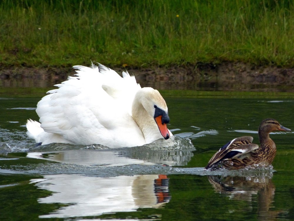
Gulls, Terns, etc

These birds are all associated with marine environments, but the truth is, they don’t care. You’ll find them wherever there is food. Since no place in New Jersey is really very far from the ocean, you can find most of these almost anywhere.

Herring Gull

Adult

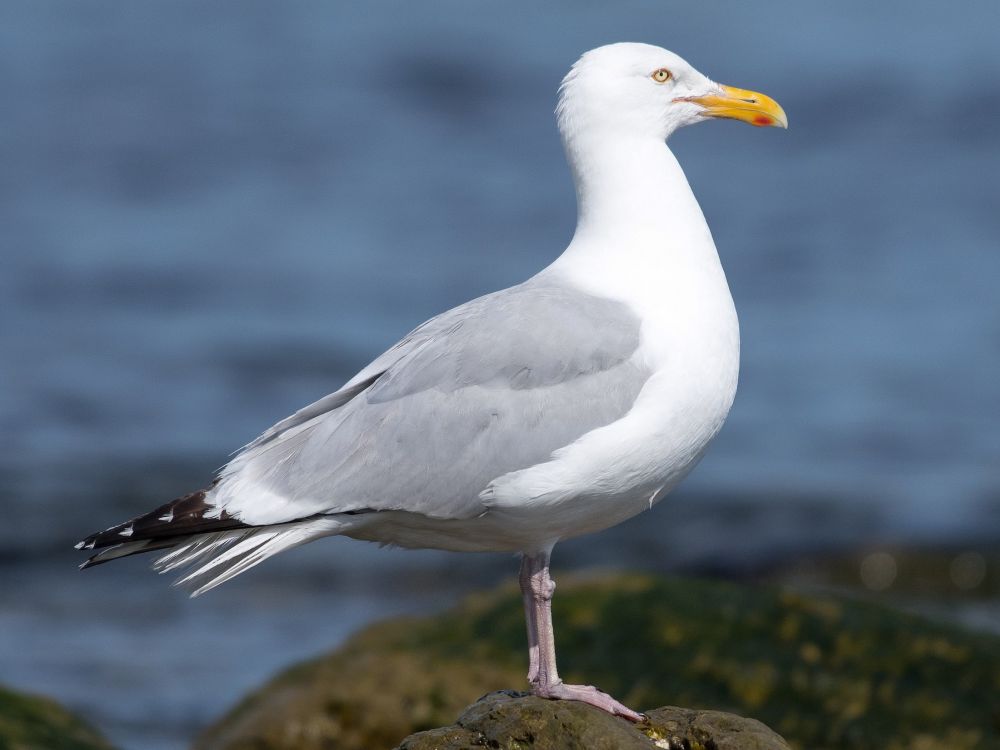
While commonly thought of as sea birds, Herring Gulls may be found wherever they feel like going. That means saltwater, freshwater, no water – if there is something to eat, you will probably find these birds there. They do not migrate.

Adult

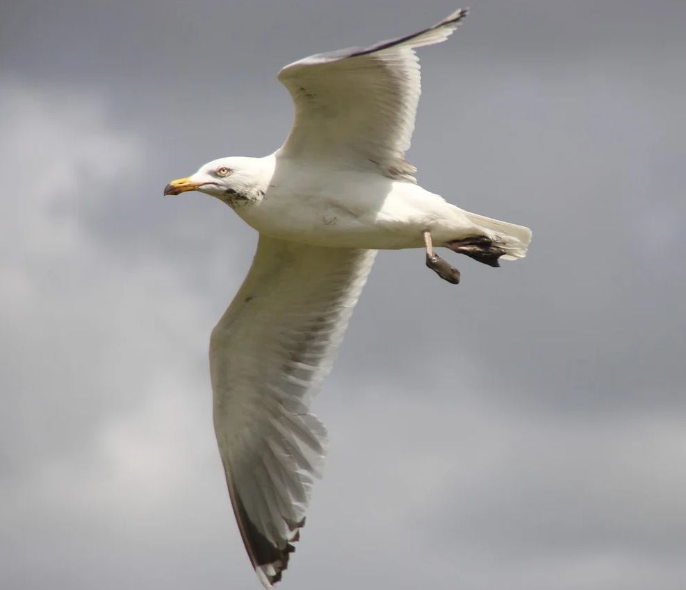
Note the all-white head, and white belly and under-wings with dark tips. Young birds are dirty brown, adults have a brown-speckled head and breast in winter.

Wikipedia


Laughing Gull

Mating colors- black head, red bill

The Laughing Gull is smaller than the Herring Gull, and tends to get bullied by them when competing for food. The Laughing Gull is less likely to be seen away from salt water, although they are found in the Great Lakes.

Outside of mating season, the head fades to white and the bill turns black. You never see them around here like that, because they migrate away for the winter.

Wikipedia


Common Tern

The Common Tern is smaller and slimmer than the Laughing Gull, with a black cap rather than a black head. This bird is found the world over, and far inland in many places. They migrate south for the winter.
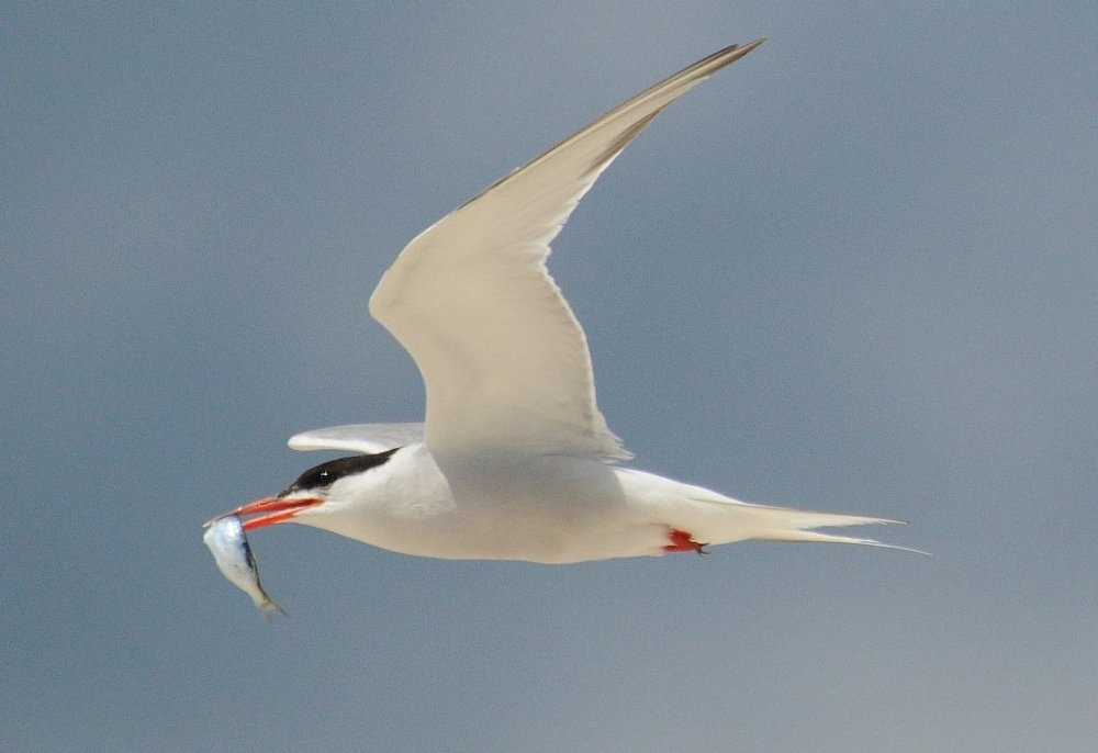
Wikipedia


Black Skimmer

This is a very cool bird to see. It is like a large dark sea gull, but the picture below really tells it all:

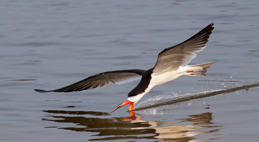
These birds winter in the south, but breed here, and can be pretty common. I’ve never seen one in fresh water.

Wikipedia


Delaware River (North)
( 40.89000, -75.16000 )

  1. Big Timber Creek - Fort Nassau ( 39.88024, -75.12680 )
  2. Delaware Bay - East Point ( 39.19403, -75.02600 )
  3. Delaware Bay - Fortescue ( 39.22920, -75.16834 )
  4. Delaware Bay - Moore's Beach ( 39.18944, -74.95113 )
  5. Delaware Bay - Nantuxent Creek ( 39.28094, -75.24193 )
  6. Delaware Bay - New Sweden ( 39.29765, -75.24765 )
  7. Delaware Bay - Norbury's Landing ( 39.05033, -74.92742 )
  8. Delaware Bay - Sea Breeze ( 39.32315, -75.32094 )
  9. Delaware Bay - Sunset Beach ( 38.94432, -74.97012 )
  10. Delaware Bay - Thompson's Beach ( 39.19244, -74.99485 )
  11. Delaware Canal - Easton PA ( 40.68791, -75.20420 )
  12. Delaware Canal - Morrisville PA ( 40.21792, -74.77976 )
  13. Delaware Canal - New Hope ( 40.37983, -74.95835 )
  14. Delaware Canal - Newtown PA ( 40.26858, -74.86017 )
  15. Delaware Canal - Washington's X'ing PA ( 40.29014, -74.87709 )
  16. Delaware Canal - Yardley PA ( 40.23742, -74.82909 )
  17. Delaware River ( 40.17371, -74.84843 )
  18. Delaware River - Belvidere ( 40.82810, -75.08299 )
  19. Delaware River - Beverly ( 40.06894, -74.92243 )
  20. Delaware River - Bordentown ( 40.14816, -74.71812 )
  21. Delaware River - Burlington ( 40.08236, -74.85662 )
  22. Delaware River - Burlington ( 40.08192, -74.85063 )
  23. Delaware River - Byram ( 40.41550, -75.04780 )
  24. Delaware River - Caddo Access ( 41.31834, -74.79522 )
  25. Delaware River - Carney's Point ( 39.71737, -75.47630 )
  26. Delaware River - Dingman's Ferry PA ( 41.21942, -74.86017 )
  27. Delaware River - DR Trailhead ( 40.55255, -75.07909 )
  28. Delaware River - Easton PA ( 40.68995, -75.20448 )
  29. Delaware River - Elsinboro Point ( 39.54510, -75.52995 )
  30. Delaware River - Florence Twp ( 40.12238, -74.80412 )
  31. Delaware River - Fort Mott ( 39.60585, -75.55596 )
  32. Delaware River - Frenchtown ( 40.53633, -75.06492 )
  33. Delaware River - Kingwood ( 40.51265, -75.06306 )
  34. Delaware River - Kittatinny ( 40.96963, -75.12837 )
  35. Delaware River - Lambertville (N) ( 40.36072, -74.94531 )
  36. Delaware River - Lambertville (S) ( 40.34235, -74.94193 )
  37. Delaware River - Mad Horse ( 39.42123, -75.42695 )
  38. Delaware River - Miller Road ( 39.38263, -75.40641 )
  39. Delaware River - North Camden ( 39.95769, -75.11432 )
  40. Delaware River - Palmyra Cove ( 40.00916, -75.04176 )
  41. Delaware River - Paulsboro ( 39.84785, -75.25124 )
  42. Delaware River - Pennsauken ( 39.98092, -75.06567 )
  43. Delaware River - Pennsville ( 39.64836, -75.53254 )
  44. Delaware River - Philipsburg ( 40.69229, -75.20329 )
  45. Delaware River - Port Jervis NY ( 41.37715, -74.70473 )
  46. Delaware River - Portland PA ( 40.92351, -75.09649 )
  47. Delaware River - Poxono ( 41.04019, -75.02293 )
  48. Delaware River - Riegelsville ( 40.59222, -75.18845 )
  49. Delaware River - Rivergate ( 39.87718, -75.17961 )
  50. Delaware River - Riverside ( 40.03775, -74.97833 )
  51. Delaware River - Rockcores Trailhead ( 41.01750, -75.07020 )
  52. Delaware River - Titusville ( 40.30711, -74.88066 )
  53. Delaware River - Trenton ( 40.18662, -74.75351 )
  54. Delaware River - Turtle Beach ( 41.03352, -75.03776 )
  55. Delaware River - West Deptford ( 39.86198, -75.20709 )
  56. Delaware River - Worthington ( 41.00505, -75.10455 )
  57. Lehigh Canal - Easton PA ( 40.66393, -75.23720 )
  58. Lehigh River - Bethleham PA ( 40.64488, -75.27186 )
  59. Lehigh River - Easton PA ( 40.68816, -75.20483 )
  60. Lehigh River - Easton PA (W) ( 40.67338, -75.23520 )
  61. Oldman's Creek - Bridgeport ( 39.78437, -75.40694 )
  62. Raccoon Creek - Bridgeport ( 39.80121, -75.35517 )
  63. Repaupo Creek - Logan Twp ( 39.82960, -75.33016 )

The Delaware River (and Bay) are too big to fit into the county-based scheme of this website, so I gave it its own top-level page. These maps include the adjacent canals, which are good places in themselves to go, but often obstruct access to the river. Zoom in to separate the markers. The green line is the approximate limit of the Delaware River drainage.

Printed from njkayak.net