Barnegat Bay
- Barnegat Bay - Barnegat ( 39.75401, -74.20171 )
- Barnegat Bay - Barnegat Light (N) ( 39.75763, -74.11138 )
- Barnegat Bay - Barnegat Light (S) ( 39.74500, -74.11764 )
- Barnegat Bay - Bay Harbor Park ( 40.01977, -74.12731 )
- Barnegat Bay - Beach Haven ( 39.57015, -74.23933 )
- Barnegat Bay - Brant Beach ( 39.61673, -74.20110 )
- Barnegat Bay - Bridge to Nowhere ( 39.68394, -74.20766 )
- Barnegat Bay - Great Bay Blvd ( 39.56316, -74.34202 )
- Barnegat Bay - Harvey Cedars ( 39.70465, -74.13703 )
- Barnegat Bay - Island Beach SP ( 39.85222, -74.08899 )
- Barnegat Bay - Lavallette ( 39.96933, -74.07421 )
- Barnegat Bay - Little Egg Harbor ( 39.53556, -74.26441 )
- Barnegat Bay - Mantoloking Bridge ( 40.04124, -74.05880 )
- Barnegat Bay - Oyster Creek ( 39.80873, -74.18455 )
- Barnegat Bay - Parkertown ( 39.60978, -74.29231 )
- Barnegat Bay - Seaside Heights ( 39.94524, -74.07956 )
- Barnegat Bay - Sedge Island ( 39.80786, -74.09599 )
- Barnegat Bay - Ship Bottom ( 39.65232, -74.18484 )
- Barnegat Bay - Surf City ( 39.65966, -74.17848 )
- Barnegat Bay - Tilton Point ( 39.96900, -74.11284 )
- Barnegat Bay - Tuckerton ( 39.57671, -74.33078 )
- Barnegat Bay - West Creek ( 39.63100, -74.29618 )
- Barnegat Bay - Woodville ( 39.98917, -74.13476 )
- Bay Parkway - Lacey ( 39.80572, -74.17212 )
- Cedar Creek - Lanoka Harbor ( 39.86936, -74.17065 )
- Great Bay - Graveling Point ( 39.53949, -74.38761 )
- Great Bay - Great Bay Blvd ( 39.52160, -74.31849 )
- Great Bay - Great Bay Blvd (end) ( 39.50902, -74.32008 )
- Great Bay - Motts Creek ( 39.51826, -74.43637 )
- Great Bay - Rand's Marina ( 39.53934, -74.32614 )
- Metedeconk River - Sandy Point ( 40.05129, -74.07785 )
- Toms River - Oceangate Beach ( 39.92840, -74.13547 )
The Point Pleasant Canal is off-limits. You'd have to be crazy anyway.
- Bamber Lake - Lacey ( 39.89577, -74.31959 )
- Barnegat Bay - Barnegat ( 39.75401, -74.20171 )
- Barnegat Bay - Barnegat Light (N) ( 39.75763, -74.11138 )
- Barnegat Bay - Barnegat Light (S) ( 39.74500, -74.11764 )
- Barnegat Bay - Bay Harbor Park ( 40.01977, -74.12731 )
- Barnegat Bay - Beach Haven ( 39.57015, -74.23933 )
- Barnegat Bay - Brant Beach ( 39.61673, -74.20110 )
- Barnegat Bay - Bridge to Nowhere ( 39.68394, -74.20766 )
- Barnegat Bay - Great Bay Blvd ( 39.56316, -74.34202 )
- Barnegat Bay - Harvey Cedars ( 39.70465, -74.13703 )
- Barnegat Bay - Island Beach SP ( 39.85222, -74.08899 )
- Barnegat Bay - Lavallette ( 39.96933, -74.07421 )
- Barnegat Bay - Little Egg Harbor ( 39.53556, -74.26441 )
- Barnegat Bay - Mantoloking Bridge ( 40.04124, -74.05880 )
- Barnegat Bay - Oyster Creek ( 39.80873, -74.18455 )
- Barnegat Bay - Parkertown ( 39.60978, -74.29231 )
- Barnegat Bay - Seaside Heights ( 39.94524, -74.07956 )
- Barnegat Bay - Sedge Island ( 39.80786, -74.09599 )
- Barnegat Bay - Ship Bottom ( 39.65232, -74.18484 )
- Barnegat Bay - Surf City ( 39.65966, -74.17848 )
- Barnegat Bay - Tilton Point ( 39.96900, -74.11284 )
- Barnegat Bay - Tuckerton ( 39.57671, -74.33078 )
- Barnegat Bay - West Creek ( 39.63100, -74.29618 )
- Barnegat Bay - Woodville ( 39.98917, -74.13476 )
- Bass River - New Gretna ( 39.57721, -74.45079 )
- Batsto River - Wharton State Forest ( 39.71014, -74.66747 )
- Bay Parkway - Lacey ( 39.80572, -74.17212 )
- Bunker Hill Bogs - Jackson ( 40.08255, -74.29256 )
- Cedar Creek - Berkeley ( 39.90248, -74.24513 )
- Cedar Creek - Double Trouble ( 39.89402, -74.22495 )
- Cedar Creek - Lanoka Harbor ( 39.86936, -74.17065 )
- Cedar Run - Stafford ( 39.64365, -74.24592 )
- Chip's Folly Campground ( 39.63281, -74.49799 )
- Collier's Lake - New Egypt ( 40.06799, -74.44856 )
- Country Lake - Pemberton ( 39.94530, -74.54257 )
- Crosswick's Creek - New Egypt (N) ( 40.08505, -74.54006 )
- Crosswick's Creek - New Egypt (S) ( 40.06679, -74.53226 )
- Deer Head Lake ( 39.85043, -74.21101 )
- Forge Pond - Brick ( 40.06646, -74.13446 )
- Great Bay - Graveling Point ( 39.53949, -74.38761 )
- Great Bay - Great Bay Blvd ( 39.52160, -74.31849 )
- Great Bay - Great Bay Blvd (end) ( 39.50902, -74.32008 )
- Great Bay - Motts Creek ( 39.51826, -74.43637 )
- Great Bay - Rand's Marina ( 39.53934, -74.32614 )
- Harry Wright Lake ( 39.93076, -74.35880 )
- Holiday Lake - Barnegat ( 39.73882, -74.26470 )
- Horicon Lake - Lakehurst ( 40.00720, -74.32177 )
- Island Beach SP Marina ( 39.90606, -74.08713 )
- Lake Absegami - Bass River ( 39.62529, -74.42760 )
- Lake Barnegat ( 39.84169, -74.20078 )
- Lake Carasaljo - Lakewood ( 40.09304, -74.22817 )
- Lake Riviera - Brick ( 40.04590, -74.14573 )
- Lake Shenandoah - Lakewood ( 40.08845, -74.19941 )
- Lake Success - Jackson ( 40.05785, -74.39243 )
- Lebanon Lake - Pemberton ( 39.90686, -74.56550 )
- Little Pine Lake - Pemberton ( 39.98857, -74.57096 )
- Manahawkin Lake - Stafford ( 39.69641, -74.26116 )
- Manasquan Reservoir - Howell ( 40.17217, -74.20300 )
- Manasquan River - Allaire ( 40.14376, -74.11673 )
- Manasquan River - Beverly Beach ( 40.10498, -74.09649 )
- Manasquan River - Brice Park ( 40.13764, -74.11038 )
- Manasquan River - Dog Beach ( 40.10623, -74.03785 )
- Manasquan River - Glimmer Glass ( 40.11653, -74.04946 )
- Manasquan River - Howell ( 40.17519, -74.16981 )
- Manasquan River - Ramshorn Drive ( 40.11961, -74.09418 )
- Manasquan River - Riverfront Park ( 40.08835, -74.07142 )
- Manasquan River - RR Bridge ( 40.10052, -74.04905 )
- Manasquan River - WMA ( 40.13689, -74.10431 )
- Metedeconk River - Bay Ave ( 40.06602, -74.05130 )
- Metedeconk River - Bay Blvd ( 40.06288, -74.05502 )
- Metedeconk River - Bennett's Pond ( 40.13058, -74.28406 )
- Metedeconk River - Brick ( 40.05687, -74.11203 )
- Metedeconk River - Dock Rd ( 40.05055, -74.11413 )
- Metedeconk River - Sandy Point ( 40.05129, -74.07785 )
- Mirror Lake - Pemberton (N) ( 39.97209, -74.56941 )
- Mirror Lake - Pemberton (S) ( 39.96729, -74.57847 )
- Mullica River - Hay Road Beach ( 39.57349, -74.53943 )
- Oswego Lake - Penn State Forest ( 39.73454, -74.49111 )
- Oswego River - Martha Bridge ( 39.68159, -74.51416 )
- Oyster Creek ( 39.80866, -74.18460 )
- Pine Lake ( 40.00910, -74.24948 )
- Presidential Lakes - Pemberton ( 39.91110, -74.57680 )
- Prospertown Lake - Jackson ( 40.13497, -74.45779 )
- Rancocas Creek - New Lisbon ( 39.96205, -74.64102 )
- Rancocas Creek - Pemberton (E) ( 39.96746, -74.58789 )
- Rancocas Creek - Pemberton Heights ( 39.96244, -74.65567 )
- Stafford Forge WMA - Manahawkin ( 39.66881, -74.32090 )
- Stockton Lake - Manasquan ( 40.11739, -74.03460 )
- Sunken Branch - Toms River ( 39.96792, -74.24211 )
- Toms River - Beachwood ( 39.94250, -74.18446 )
- Toms River - Cranmoor Manor ( 39.94859, -74.16332 )
- Toms River - Gilford Park ( 39.94262, -74.13393 )
- Toms River - Huddy Park ( 39.95082, -74.19782 )
- Toms River - Oceangate Beach ( 39.92840, -74.13547 )
- Toms River - Pine Beach ( 39.93789, -74.15776 )
- Toms River - Pine Lake Park ( 40.00353, -74.24106 )
- Toms River - Pocket Park ( 39.94102, -74.17354 )
- Toms River - Rt 527 ( 39.98639, -74.22380 )
- Toms River - Water St ( 39.95171, -74.19990 )
- Toms River - Winding River Park (N) ( 39.98350, -74.22255 )
- Toms River - Winding River Park (S) ( 39.96802, -74.21393 )
- Toms River - Windsor Park ( 39.94676, -74.15658 )
- Turn Mill Pond - New Egypt ( 40.06371, -74.44772 )
- Twilight Lake - Bay Head ( 40.07474, -74.04404 )
- Wading River - Beaver Branch ( 39.65059, -74.51890 )
- Wading River - Bodine Field Road ( 39.65401, -74.52497 )
- Wading River - Evans Bridge ( 39.67517, -74.54066 )
- Wading River - Godfrey Bridge ( 39.68987, -74.54612 )
- Wading River - Harrisville Pond ( 39.66547, -74.52434 )
- Wading River - Hawkins Bridge ( 39.71442, -74.56595 )
- Wells Mills Pond ( 39.79387, -74.27701 )
- Whitesbog - Pemberton ( 39.96504, -74.48711 )
- Wreck Pond - Sea Girt ( 40.13880, -74.02726 )
- Wreck Pond - Spring Lake ( 40.14107, -74.04003 )
More: Ocean County ...
- Manasquan River - Allaire ( 40.14376, -74.11673 )
- Manasquan River - Beverly Beach ( 40.10498, -74.09649 )
- Manasquan River - Brice Park ( 40.13764, -74.11038 )
- Manasquan River - Dog Beach ( 40.10623, -74.03785 )
- Manasquan River - Glimmer Glass ( 40.11653, -74.04946 )
- Manasquan River - Howell ( 40.17519, -74.16981 )
- Manasquan River - Ramshorn Drive ( 40.11961, -74.09418 )
- Manasquan River - Riverfront Park ( 40.08835, -74.07142 )
- Manasquan River - RR Bridge ( 40.10052, -74.04905 )
- Manasquan River - WMA ( 40.13689, -74.10431 )
The Point Pleasant Canal is off-limits.
More: Manasquan River ...
- Barnegat Bay - Mantoloking Bridge ( 40.04124, -74.05880 )
- Forge Pond - Brick ( 40.06646, -74.13446 )
- Lake Carasaljo - Lakewood ( 40.09304, -74.22817 )
- Lake Shenandoah - Lakewood ( 40.08845, -74.19941 )
- Metedeconk River - Bay Ave ( 40.06602, -74.05130 )
- Metedeconk River - Bay Blvd ( 40.06288, -74.05502 )
- Metedeconk River - Bennett's Pond ( 40.13058, -74.28406 )
- Metedeconk River - Brick ( 40.05687, -74.11203 )
- Metedeconk River - Dock Rd ( 40.05055, -74.11413 )
- Metedeconk River - Sandy Point ( 40.05129, -74.07785 )
The Point Pleasant Canal is off-limits.
More: Metedeconk River ...
- Pine Lake ( 40.00910, -74.24948 )
- Sunken Branch - Toms River ( 39.96792, -74.24211 )
- Toms River - Beachwood ( 39.94250, -74.18446 )
- Toms River - Cranmoor Manor ( 39.94859, -74.16332 )
- Toms River - Gilford Park ( 39.94262, -74.13393 )
- Toms River - Huddy Park ( 39.95082, -74.19782 )
- Toms River - Oceangate Beach ( 39.92840, -74.13547 )
- Toms River - Pine Beach ( 39.93789, -74.15776 )
- Toms River - Pine Lake Park ( 40.00353, -74.24106 )
- Toms River - Pocket Park ( 39.94102, -74.17354 )
- Toms River - Rt 527 ( 39.98639, -74.22380 )
- Toms River - Water St ( 39.95171, -74.19990 )
- Toms River - Winding River Park (N) ( 39.98350, -74.22255 )
- Toms River - Winding River Park (S) ( 39.96802, -74.21393 )
- Toms River - Windsor Park ( 39.94676, -74.15658 )
More: Toms River ...
- Absecon Creek - Absecon ( 39.42635, -74.48653 )
- Atlantic City - Huron Ave ( 39.38023, -74.42392 )
- Barnegat Bay - Beach Haven ( 39.57015, -74.23933 )
- Barnegat Bay - Brant Beach ( 39.61673, -74.20110 )
- Barnegat Bay - Great Bay Blvd ( 39.56316, -74.34202 )
- Barnegat Bay - Little Egg Harbor ( 39.53556, -74.26441 )
- Barnegat Bay - Parkertown ( 39.60978, -74.29231 )
- Barnegat Bay - Tuckerton ( 39.57671, -74.33078 )
- Barnegat Bay - West Creek ( 39.63100, -74.29618 )
- Bass River - New Gretna ( 39.57721, -74.45079 )
- Cedar Run - Stafford ( 39.64365, -74.24592 )
- Chip's Folly Campground ( 39.63281, -74.49799 )
- Great Bay - Graveling Point ( 39.53949, -74.38761 )
- Great Bay - Great Bay Blvd ( 39.52160, -74.31849 )
- Great Bay - Great Bay Blvd (end) ( 39.50902, -74.32008 )
- Great Bay - Motts Creek ( 39.51826, -74.43637 )
- Great Bay - Rand's Marina ( 39.53934, -74.32614 )
- Lake Absegami - Bass River ( 39.62529, -74.42760 )
- Mullica River - Hay Road Beach ( 39.57349, -74.53943 )
- Nacote Creek - Port Republic ( 39.51768, -74.49363 )
- Reeds Bay - Absecon ( 39.44306, -74.46194 )
- Somers Bay - Brigantine ( 39.40916, -74.36937 )
- Stafford Forge WMA - Manahawkin ( 39.66881, -74.32090 )
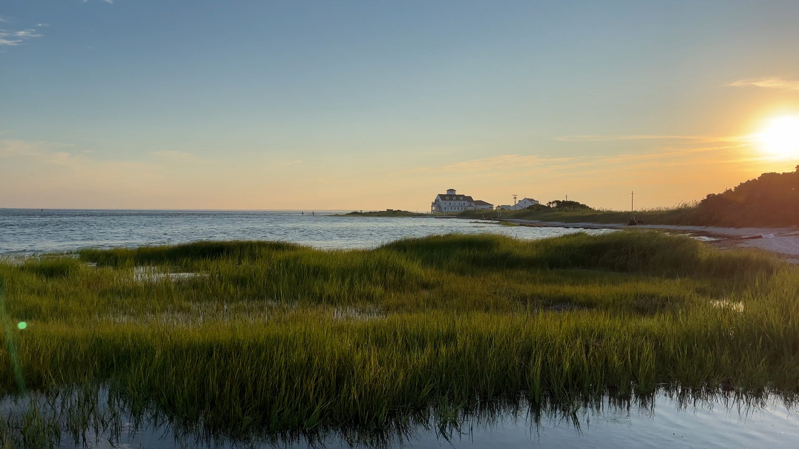
The Great Bay Boulevard Wildlife Management Area in Ocean County is 5,982 acres of fresh, brackish and saltwater estuary and islands acquired with funding from hunters and anglers, Green Acres and the sale of waterfowl stamps. The boulevard is a narrow two-lane road that was the beginning of a causeway to the shore that would have connected Great Bay to Atlantic City.
The road was never opened, but now provides access to a great sweep of salt marsh, with opportunities for fishing, birdwatching or simply enjoying the beautiful scenery. Great Bay is considered one of the least-disturbed marine wetland habitats in the northeastern United States.
-- NJDEP
More: Great Bay Blvd WMA - Tuckerton ...
Questions or Inquiries?
Just want to say Hello? Sign the .