Burlington County

Burlington County
( 39.87142, -74.67547 )

  1. Atsion Lake - Pinelands ( 39.73989, -74.73128 )
  2. Bamber Lake - Lacey ( 39.89577, -74.31959 )
  3. Bass River - New Gretna ( 39.57721, -74.45079 )
  4. Batsto Lake - Batsto ( 39.64682, -74.65327 )
  5. Batsto River - Wharton State Forest ( 39.71014, -74.66747 )
  6. Big Timber Creek - Fort Nassau ( 39.88024, -75.12680 )
  7. Big Timber Creek - Glendora (N) ( 39.85285, -75.09452 )
  8. Big Timber Creek - Glendora (S) ( 39.83769, -75.08264 )
  9. Blackwood Lake - Big Timber Creek ( 39.80194, -75.07405 )
  10. Bunker Hill Bogs - Jackson ( 40.08255, -74.29256 )
  11. Cedar Creek - Berkeley ( 39.90248, -74.24513 )
  12. Cedar Creek - Double Trouble ( 39.89402, -74.22495 )
  13. Chip's Folly Campground ( 39.63281, -74.49799 )
  14. Collier's Lake - New Egypt ( 40.06799, -74.44856 )
  15. Cooper River - Haddonfield ( 39.90090, -75.02056 )
  16. Cooper River Lake - Collingswood ( 39.92432, -75.07123 )
  17. Cooper River Park - Haddonfield ( 39.92561, -75.05672 )
  18. Country Lake - Pemberton ( 39.94530, -74.54257 )
  19. Crosswick's Creek - Bordentown ( 40.14816, -74.71812 )
  20. Crosswick's Creek - Groveville ( 40.16705, -74.67717 )
  21. Crosswick's Creek - New Egypt (N) ( 40.08505, -74.54006 )
  22. Crosswick's Creek - New Egypt (S) ( 40.06679, -74.53226 )
  23. Crosswick's Creek - Walnford ( 40.13480, -74.55762 )
  24. D-R Canal - Trenton (S) ( 40.18384, -74.74666 )
  25. Deep Run - Wharton State Forest ( 39.76288, -74.69219 )
  26. Deer Head Lake ( 39.85043, -74.21101 )
  27. Delaware Canal - Morrisville PA ( 40.21792, -74.77976 )
  28. Delaware River - Beverly ( 40.06894, -74.92243 )
  29. Delaware River - Burlington ( 40.08236, -74.85662 )
  30. Delaware River - Burlington ( 40.08192, -74.85063 )
  31. Delaware River - Florence Twp ( 40.12238, -74.80412 )
  32. Delaware River - Frankford Creek ( 39.98473, -75.07171 )
  33. Delaware River - North Camden ( 39.95769, -75.11432 )
  34. Delaware River - Palmyra Cove ( 40.00916, -75.04176 )
  35. Delaware River - Pennsauken ( 39.98092, -75.06567 )
  36. Delaware River - Riverside ( 40.03775, -74.97833 )
  37. Delaware River - Trenton ( 40.18662, -74.75351 )
  38. Dramasel/Pines Lake ( 39.81713, -75.04735 )
  39. Great Egg Harbor River - New Brooklyn ( 39.70187, -74.93732 )
  40. Great Egg Harbor River - Penny Pot ( 39.57547, -74.82239 )
  41. Great Egg Harbor River - Piney Hollow Rd ( 39.62049, -74.89280 )
  42. Gropp Lake - White Horse ( 40.18761, -74.68888 )
  43. Hammonton Lake ( 39.63010, -74.78734 )
  44. Harry Wright Lake ( 39.93076, -74.35880 )
  45. Holiday Lake - Barnegat ( 39.73882, -74.26470 )
  46. Horicon Lake - Lakehurst ( 40.00720, -74.32177 )
  47. Indian Mills Lake ( 39.79554, -74.73998 )
  48. Kirkwood Lake - Cooper River ( 39.83637, -75.00105 )
  49. Lake Absegami - Bass River ( 39.62529, -74.42760 )
  50. Lake Success - Jackson ( 40.05785, -74.39243 )
  51. Laurel Lake ( 39.81720, -75.01032 )
  52. Lebanon Lake - Pemberton ( 39.90686, -74.56550 )
  53. Little Pine Lake - Pemberton ( 39.98857, -74.57096 )
  54. Makepeace Lake ( 39.54717, -74.75058 )
  55. Mirror Lake - Pemberton (N) ( 39.97209, -74.56941 )
  56. Mirror Lake - Pemberton (S) ( 39.96729, -74.57847 )
  57. Mullica River - Batsto ( 39.63973, -74.65889 )
  58. Mullica River - Crowley Landing ( 39.62640, -74.61922 )
  59. Mullica River - Hay Road Beach ( 39.57349, -74.53943 )
  60. Mullica River - Sweetwater Marina ( 39.62171, -74.62512 )
  61. Newton Creek - Johnson Park ( 39.89464, -75.11321 )
  62. Newton Lake - Collingswood ( 39.90840, -75.08179 )
  63. Oswego Lake - Penn State Forest ( 39.73454, -74.49111 )
  64. Oswego River - Martha Bridge ( 39.68159, -74.51416 )
  65. Pennsauken Creek - Cinnaminson (E) ( 39.97961, -75.00867 )
  66. Pennsauken Creek - Cinnaminson (W) ( 39.98056, -75.01119 )
  67. Pine Lake ( 40.00910, -74.24948 )
  68. Presidential Lakes - Pemberton ( 39.91110, -74.57680 )
  69. Prospertown Lake - Jackson ( 40.13497, -74.45779 )
  70. Rancocas Creek - Birmingham ( 39.97927, -74.70974 )
  71. Rancocas Creek - Hainesport ( 39.98489, -74.84372 )
  72. Rancocas Creek - Kirby's Mill ( 39.91685, -74.80555 )
  73. Rancocas Creek - Lumberton ( 39.96856, -74.81406 )
  74. Rancocas Creek - Medford Park ( 39.89713, -74.82061 )
  75. Rancocas Creek - Mt Holly (E) ( 39.99028, -74.77972 )
  76. Rancocas Creek - Mt Holly (W) ( 39.98980, -74.78956 )
  77. Rancocas Creek - New Lisbon ( 39.96205, -74.64102 )
  78. Rancocas Creek - Pemberton (E) ( 39.96746, -74.58789 )
  79. Rancocas Creek - Pemberton (W) ( 39.97030, -74.68377 )
  80. Rancocas Creek - Pemberton Heights ( 39.96244, -74.65567 )
  81. Rancocas Creek - Smithville ( 39.98571, -74.75083 )
  82. Rancocas Creek - Willingboro ( 40.02992, -74.92946 )
  83. Spring Lake ( 40.19512, -74.73217 )
  84. Stafford Forge WMA - Manahawkin ( 39.66881, -74.32090 )
  85. Stewart Lake - Woodbury ( 39.84193, -75.14283 )
  86. Stone Tavern Lake - Upper Freehold ( 40.19587, -74.48596 )
  87. Strawberry Lake - Moorestown ( 39.95460, -74.94940 )
  88. Strawbridge Lake - Moorestown ( 39.94984, -74.96347 )
  89. Sunken Branch - Toms River ( 39.96792, -74.24211 )
  90. Timber Creek ( 39.83638, -75.05988 )
  91. Toms River - Pine Lake Park ( 40.00353, -74.24106 )
  92. Turn Mill Pond - New Egypt ( 40.06371, -74.44772 )
  93. Wading River - Beaver Branch ( 39.65059, -74.51890 )
  94. Wading River - Bodine Field Road ( 39.65401, -74.52497 )
  95. Wading River - Evans Bridge ( 39.67517, -74.54066 )
  96. Wading River - Godfrey Bridge ( 39.68987, -74.54612 )
  97. Wading River - Harrisville Pond ( 39.66547, -74.52434 )
  98. Wading River - Hawkins Bridge ( 39.71442, -74.56595 )
  99. Wells Mills Pond ( 39.79387, -74.27701 )
  100. Whitesbog - Pemberton ( 39.96504, -74.48711 )
  101. Wilson Lake - Glassboro ( 39.65715, -75.05088 )

Delaware River (North)
( 40.76010, -75.16000 )

  1. Big Timber Creek - Fort Nassau ( 39.88024, -75.12680 )
  2. Crosswick's Creek - Bordentown ( 40.14816, -74.71812 )
  3. Delaware Bay - Bidwell Creek ( 39.12731, -74.89085 )
  4. Delaware Bay - East Point ( 39.19403, -75.02600 )
  5. Delaware Bay - Fortescue ( 39.22920, -75.16834 )
  6. Delaware Bay - Moore's Beach ( 39.18944, -74.95113 )
  7. Delaware Bay - Nantuxent Creek ( 39.28094, -75.24193 )
  8. Delaware Bay - New Sweden ( 39.29765, -75.24765 )
  9. Delaware Bay - Norbury's Landing ( 39.05033, -74.92742 )
  10. Delaware Bay - Sea Breeze ( 39.32315, -75.32094 )
  11. Delaware Bay - Sunset Beach ( 38.94432, -74.97012 )
  12. Delaware Bay - Thompson's Beach ( 39.19244, -74.99485 )
  13. Delaware Canal - Easton PA ( 40.68791, -75.20420 )
  14. Delaware Canal - Morrisville PA ( 40.21792, -74.77976 )
  15. Delaware Canal - New Hope ( 40.37983, -74.95835 )
  16. Delaware Canal - Newtown PA ( 40.26858, -74.86017 )
  17. Delaware Canal - Washington's X'ing PA ( 40.29014, -74.87709 )
  18. Delaware Canal - Yardley PA ( 40.23742, -74.82909 )
  19. Delaware River - Belvidere ( 40.82810, -75.08299 )
  20. Delaware River - Beverly ( 40.06894, -74.92243 )
  21. Delaware River - Burlington ( 40.08236, -74.85662 )
  22. Delaware River - Burlington ( 40.08192, -74.85063 )
  23. Delaware River - Byram ( 40.41550, -75.04780 )
  24. Delaware River - Caddo Access ( 41.31834, -74.79522 )
  25. Delaware River - Carney's Point ( 39.71737, -75.47630 )
  26. Delaware River - Dingman's Ferry PA ( 41.21942, -74.86017 )
  27. Delaware River - DR Trailhead ( 40.55255, -75.07909 )
  28. Delaware River - Easton PA ( 40.68995, -75.20448 )
  29. Delaware River - Elsinboro Point ( 39.54510, -75.52995 )
  30. Delaware River - Florence Twp ( 40.12238, -74.80412 )
  31. Delaware River - Fort Mott ( 39.60585, -75.55596 )
  32. Delaware River - Frankford Creek ( 39.98473, -75.07171 )
  33. Delaware River - Frenchtown ( 40.53633, -75.06492 )
  34. Delaware River - Frenchtown ( 40.52567, -75.06304 )
  35. Delaware River - Giving Pond ( 40.53956, -75.06898 )
  36. Delaware River - Kingwood ( 40.51265, -75.06306 )
  37. Delaware River - Kittatinny ( 40.96963, -75.12837 )
  38. Delaware River - Lambertville (N) ( 40.36072, -74.94531 )
  39. Delaware River - Lambertville (S) ( 40.34235, -74.94193 )
  40. Delaware River - Mad Horse ( 39.42123, -75.42695 )
  41. Delaware River - Miller Road ( 39.38263, -75.40641 )
  42. Delaware River - North Camden ( 39.95769, -75.11432 )
  43. Delaware River - Palmyra Cove ( 40.00916, -75.04176 )
  44. Delaware River - Paulsboro ( 39.84785, -75.25124 )
  45. Delaware River - Pennsauken ( 39.98092, -75.06567 )
  46. Delaware River - Pennsville ( 39.64836, -75.53254 )
  47. Delaware River - Philipsburg ( 40.69229, -75.20329 )
  48. Delaware River - Port Jervis NY ( 41.37715, -74.70473 )
  49. Delaware River - Portland PA ( 40.92351, -75.09649 )
  50. Delaware River - Poxono ( 41.04019, -75.02293 )
  51. Delaware River - Riegelsville ( 40.59222, -75.18845 )
  52. Delaware River - Rivergate ( 39.87718, -75.17961 )
  53. Delaware River - Riverside ( 40.03775, -74.97833 )
  54. Delaware River - Rockcores Trailhead ( 41.01750, -75.07020 )
  55. Delaware River - Titusville ( 40.30711, -74.88066 )
  56. Delaware River - Trenton ( 40.18662, -74.75351 )
  57. Delaware River - Turtle Beach ( 41.03352, -75.03776 )
  58. Delaware River - West Deptford ( 39.86198, -75.20709 )
  59. Delaware River - Worthington ( 41.00505, -75.10455 )
  60. Delaware River Viaduct ( 40.93771, -75.10619 )
  61. Lehigh Canal - Easton PA ( 40.66393, -75.23720 )
  62. Lehigh River - Bethleham PA ( 40.64488, -75.27186 )
  63. Lehigh River - Easton PA ( 40.68816, -75.20483 )
  64. Lehigh River - Easton PA (W) ( 40.67338, -75.23520 )
  65. Oldman's Creek - Bridgeport ( 39.78437, -75.40694 )
  66. Raccoon Creek - Bridgeport ( 39.80121, -75.35517 )
  67. Repaupo Creek - Logan Twp ( 39.82960, -75.33016 )

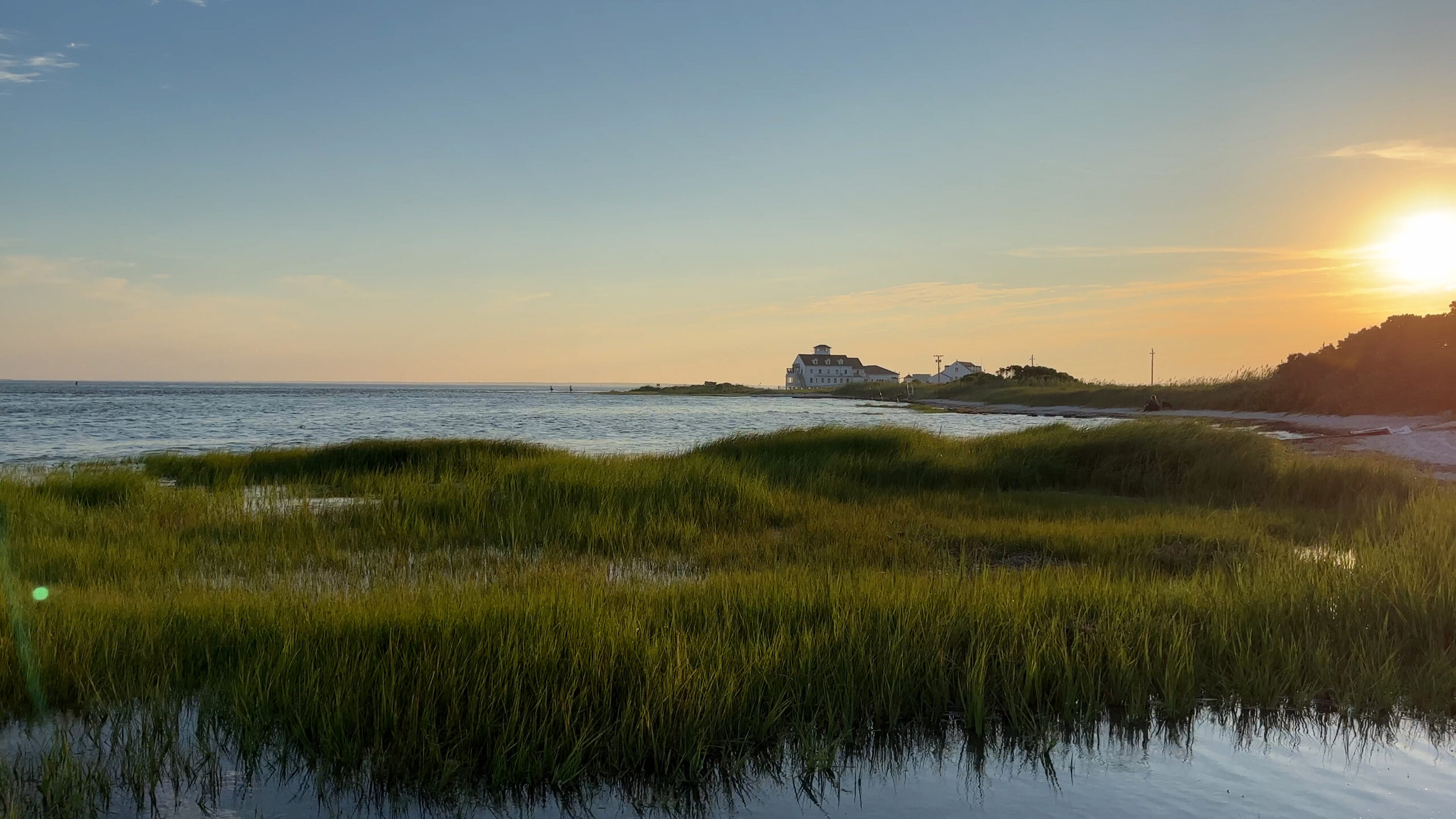
The Delaware River (and Bay) are too big to fit into the county-based scheme of this website, so I gave it its own top-level page. These maps include the adjacent canals, which are good places in themselves to go, but often obstruct access to the river. Zoom in to separate the markers. The orange line is the approximate limit of the Delaware River drainage.


Great Bay
( 39.52635, -74.35076 )

  1. Absecon Creek - Absecon ( 39.42635, -74.48653 )
  2. Atlantic City - Huron Ave ( 39.38023, -74.42392 )
  3. Barnegat Bay - Beach Haven ( 39.57015, -74.23933 )
  4. Barnegat Bay - Brant Beach ( 39.61673, -74.20110 )
  5. Barnegat Bay - Great Bay Blvd ( 39.56316, -74.34202 )
  6. Barnegat Bay - Little Egg Harbor ( 39.53556, -74.26441 )
  7. Barnegat Bay - Parkertown ( 39.60978, -74.29231 )
  8. Barnegat Bay - Tuckerton ( 39.57671, -74.33078 )
  9. Barnegat Bay - West Creek ( 39.63100, -74.29618 )
  10. Bass River - New Gretna ( 39.57721, -74.45079 )
  11. Cedar Run - Stafford ( 39.64365, -74.24592 )
  12. Chip's Folly Campground ( 39.63281, -74.49799 )
  13. Great Bay - Graveling Point ( 39.53949, -74.38761 )
  14. Great Bay - Great Bay Blvd ( 39.52160, -74.31849 )
  15. Great Bay - Great Bay Blvd (end) ( 39.50902, -74.32008 )
  16. Great Bay - Motts Creek ( 39.51826, -74.43637 )
  17. Great Bay - Rand's Marina ( 39.53934, -74.32614 )
  18. Lake Absegami - Bass River ( 39.62529, -74.42760 )
  19. Mullica River - Hay Road Beach ( 39.57349, -74.53943 )
  20. Nacote Creek - Port Republic ( 39.51768, -74.49363 )
  21. Reeds Bay - Absecon ( 39.44306, -74.46194 )
  22. Somers Bay - Brigantine ( 39.40916, -74.36937 )
  23. Stafford Forge WMA - Manahawkin ( 39.66881, -74.32090 )

The Great Bay Boulevard Wildlife Management Area in Ocean County is 5,982 acres of fresh, brackish and saltwater estuary and islands acquired with funding from hunters and anglers, Green Acres and the sale of waterfowl stamps. The boulevard is a narrow two-lane road that was the beginning of a causeway to the shore that would have connected Great Bay to Atlantic City.

The road was never opened, but now provides access to a great sweep of salt marsh, with opportunities for fishing, birdwatching or simply enjoying the beautiful scenery. Great Bay is considered one of the least-disturbed marine wetland habitats in the northeastern United States.

-- NJDEP


Mullica River
( 39.64116, -74.57847 )

  1. Atsion Lake - Pinelands ( 39.73989, -74.73128 )
  2. Batsto Lake - Batsto ( 39.64682, -74.65327 )
  3. Batsto River - Wharton State Forest ( 39.71014, -74.66747 )
  4. Great Bay - Graveling Point ( 39.53949, -74.38761 )
  5. Great Bay - Motts Creek ( 39.51826, -74.43637 )
  6. Mullica River - Batsto ( 39.63973, -74.65889 )
  7. Mullica River - Crowley Landing ( 39.62640, -74.61922 )
  8. Mullica River - Hay Road Beach ( 39.57349, -74.53943 )
  9. Mullica River - Sweetwater Marina ( 39.62171, -74.62512 )

Paddlin' in the Pines
( 39.70208, -74.42738 )

  1. Batsto Lake - Batsto ( 39.64682, -74.65327 )
  2. Batsto River - Wharton State Forest ( 39.71014, -74.66747 )
  3. Cedar Creek - Berkeley ( 39.90248, -74.24513 )
  4. Cedar Creek - Lanoka Harbor ( 39.86936, -74.17065 )
  5. Great Egg Harbor River - Penny Pot ( 39.57547, -74.82239 )
  6. Great Egg Harbor River - Weymouth ( 39.51339, -74.77889 )

This map shows the three trips described in this article

by Andrée Jannette

New Jersey Outdoors
Spring 1998
$4.25

If you don't know how to turn your canoe on a dime when you put in at your first Pinelands river, you will by the time you finish. These are narrow, winding rivers, full of sweeping curves and sharply angled switchbacks. Yet these twists and turns are very much a part of the mystique and the delight of paddling in New Jersey's Pinelands.


Rancocas Creek
( 39.98505, -74.79202 )

  1. Little Pine Lake - Pemberton ( 39.98857, -74.57096 )
  2. Mirror Lake - Pemberton (N) ( 39.97209, -74.56941 )
  3. Mirror Lake - Pemberton (S) ( 39.96729, -74.57847 )
  4. Rancocas Creek - Birmingham ( 39.97927, -74.70974 )
  5. Rancocas Creek - Hainesport ( 39.98489, -74.84372 )
  6. Rancocas Creek - Kirby's Mill ( 39.91685, -74.80555 )
  7. Rancocas Creek - Lumberton ( 39.96856, -74.81406 )
  8. Rancocas Creek - Medford Park ( 39.89713, -74.82061 )
  9. Rancocas Creek - Mt Holly (E) ( 39.99028, -74.77972 )
  10. Rancocas Creek - Mt Holly (W) ( 39.98980, -74.78956 )
  11. Rancocas Creek - New Lisbon ( 39.96205, -74.64102 )
  12. Rancocas Creek - Pemberton (E) ( 39.96746, -74.58789 )
  13. Rancocas Creek - Pemberton (W) ( 39.97030, -74.68377 )
  14. Rancocas Creek - Pemberton Heights ( 39.96244, -74.65567 )
  15. Rancocas Creek - Smithville ( 39.98571, -74.75083 )
  16. Rancocas Creek - Willingboro ( 40.02992, -74.92946 )

Pinelands
( 39.69906, -74.52654 )

  1. Chip's Folly Campground ( 39.63281, -74.49799 )
  2. Oswego Lake - Penn State Forest ( 39.73454, -74.49111 )
  3. Oswego River - Martha Bridge ( 39.68159, -74.51416 )
  4. Wading River - Beaver Branch ( 39.65059, -74.51890 )
  5. Wading River - Bodine Field Road ( 39.65401, -74.52497 )
  6. Wading River - Evans Bridge ( 39.67517, -74.54066 )
  7. Wading River - Godfrey Bridge ( 39.68987, -74.54612 )
  8. Wading River - Harrisville Pond ( 39.66547, -74.52434 )
  9. Wading River - Hawkins Bridge ( 39.71442, -74.56595 )

Middlesex County
( 40.42683, -74.38135 )

  1. Aeromarine Industrial Park ( 40.44306, -74.18967 )
  2. Ambrose Brook - Bound Brook ( 40.56764, -74.51489 )
  3. Ambrose Brook - Possumtown ( 40.55555, -74.48630 )
  4. Arthur Kill - Buckingham Ave ( 40.51462, -74.25871 )
  5. Arthur Kill - Carteret Waterfront ( 40.57186, -74.21301 )
  6. Arthur Kill - Ferry St ( 40.54576, -74.25424 )
  7. Brainerd Lake - Cranbury ( 40.31113, -74.51178 )
  8. Buck's Pond - Colt's Neck ( 40.29178, -74.20380 )
  9. D-R Canal - Amwell Rd ( 40.50340, -74.58268 )
  10. D-R Canal - Blackwells Mills ( 40.47550, -74.57220 )
  11. D-R Canal - Griggstown (N) ( 40.43834, -74.61397 )
  12. D-R Canal - Griggstown (S) ( 40.42912, -74.61816 )
  13. D-R Canal - Kingston (N) ( 40.37489, -74.61854 )
  14. D-R Canal - Kingston (S) ( 40.37326, -74.61861 )
  15. D-R Canal - Manville ( 40.52861, -74.58178 )
  16. D-R Canal - New Brunswick ( 40.50806, -74.46376 )
  17. D-R Canal - Plainsboro (E) ( 40.34321, -74.62964 )
  18. D-R Canal - Plainsboro (W) ( 40.34190, -74.63758 )
  19. D-R Canal - Princeton (N) ( 40.33879, -74.64715 )
  20. D-R Canal - Princeton (S) ( 40.33224, -74.65186 )
  21. D-R Canal - Rocky Hill ( 40.39826, -74.62702 )
  22. D-R Canal - Somerset (N) ( 40.54077, -74.51404 )
  23. D-R Canal - Somerset (S) ( 40.52390, -74.49248 )
  24. D-R Canal - South Bound Brook ( 40.55880, -74.53118 )
  25. Dallenbach Pond ( 40.41254, -74.44296 )
  26. Davidson's Mill Pond - East Brunswick ( 40.41117, -74.49789 )
  27. Etra Lake - East Windsor ( 40.25288, -74.49829 )
  28. Farrington Lake - East Brunswick (C) ( 40.42465, -74.47680 )
  29. Farrington Lake - East Brunswick (N) ( 40.43900, -74.46646 )
  30. Farrington Lake - East Brunswick (S) ( 40.42201, -74.48242 )
  31. Green Brook - Billian Legion Park ( 40.56222, -74.52483 )
  32. Grover's Mill Pond - Princeton Junction ( 40.31282, -74.60565 )
  33. Helmetta Pond ( 40.37817, -74.42657 )
  34. Lake Carnegie - Plainsboro ( 40.34362, -74.62973 )
  35. Lake Carnegie - Princeton ( 40.36681, -74.62597 )
  36. Lake Lefferts - Matawan ( 40.41563, -74.23362 )
  37. Lake Manalapan - Jamesburg ( 40.34525, -74.43662 )
  38. Lake Topanemus - Freehold ( 40.27635, -74.28554 )
  39. Lake Weamaconk - Englishtown ( 40.29140, -74.35704 )
  40. Lawrence Brook - Milltown (E) ( 40.45144, -74.43663 )
  41. Lawrence Brook - Milltown (W) ( 40.44831, -74.44367 )
  42. Marlu Lake - Lincroft ( 40.33463, -74.15354 )
  43. Mill Pond - Princeton Meadows (E) ( 40.32460, -74.56567 )
  44. Mill Pond - Princeton Meadows (W) ( 40.32735, -74.60233 )
  45. Millhurst Pond - Freehold ( 40.24590, -74.34066 )
  46. Millstone River - Blackwells Mills ( 40.47487, -74.57503 )
  47. Millstone River - Cranbury (E) ( 40.29359, -74.52675 )
  48. Millstone River - Cranbury (W) ( 40.29590, -74.56250 )
  49. Millstone River - Griggstown ( 40.43898, -74.61783 )
  50. Millstone River - Kingston ( 40.37419, -74.61962 )
  51. Millstone River - Manville ( 40.53124, -74.58753 )
  52. Millstone River - Plainsboro (N) ( 40.34262, -74.62981 )
  53. Millstone River - Plainsboro (S) ( 40.33874, -74.62880 )
  54. Millstone River - West Windsor ( 40.32139, -74.60831 )
  55. New Market Pond - Piscataway ( 40.57675, -74.45490 )
  56. Peddie Lake - Hightstown ( 40.26870, -74.52219 )
  57. Perrineville Lake ( 40.22667, -74.43784 )
  58. Rahway River - Clark ( 40.62884, -74.29746 )
  59. Rahway River - Jackson's Pond ( 40.62805, -74.28492 )
  60. Rahway River - Mohawk Park ( 40.64041, -74.29408 )
  61. Rahway River - Park ( 40.62040, -74.28944 )
  62. Rahway River - Rahway ( 40.59952, -74.26856 )
  63. Rahway River - South Branch (E) ( 40.60010, -74.27397 )
  64. Rahway River - South Branch (W) ( 40.57998, -74.30463 )
  65. Raritan Bay - Cliffwood (E) ( 40.45089, -74.22033 )
  66. Raritan Bay - Cliffwood (W) ( 40.45216, -74.22269 )
  67. Raritan Bay - Cliffwood (Whale Creek) ( 40.45090, -74.22274 )
  68. Raritan Bay - Keyport (E) ( 40.44095, -74.19534 )
  69. Raritan Bay - Keyport (W) ( 40.43921, -74.20160 )
  70. Raritan Bay - Laurence Harbor (E) ( 40.45877, -74.24622 )
  71. Raritan Bay - Laurence Harbor (W) ( 40.46223, -74.25482 )
  72. Raritan Bay - Middletown ( 40.44463, -74.11175 )
  73. Raritan Bay - Port Monmouth ( 40.43800, -74.08955 )
  74. Raritan Bay - South Amboy (N) ( 40.48343, -74.27059 )
  75. Raritan Bay - South Amboy (S) ( 40.47946, -74.26831 )
  76. Raritan Bay - South Amboy Ramp ( 40.48401, -74.27416 )
  77. Raritan Bay - Union Beach (E) ( 40.44787, -74.16598 )
  78. Raritan Bay - Union Beach (W) ( 40.45479, -74.17517 )
  79. Raritan River - Bound Brook ( 40.55995, -74.52758 )
  80. Raritan River - Edison ( 40.48791, -74.38382 )
  81. Raritan River - Highland Park ( 40.48864, -74.42226 )
  82. Raritan River - New Brunswick ( 40.48760, -74.43280 )
  83. Raritan River - Perth Amboy ( 40.50057, -74.27712 )
  84. Raritan River - Piscataway (N) ( 40.54085, -74.51236 )
  85. Raritan River - Piscataway (S) ( 40.50935, -74.46641 )
  86. Raritan River - Sayreville ( 40.47450, -74.35606 )
  87. Raritan River - Somerville (E) ( 40.55798, -74.61520 )
  88. Rising Sun Lake - Upper Freehold ( 40.20699, -74.46339 )
  89. Robinson's Branch - Rahway River ( 40.61839, -74.30495 )
  90. Rocky Brook - Hightstown ( 40.27108, -74.52353 )
  91. Shadow Lake - Middletown ( 40.34698, -74.10476 )
  92. South River - Grekoski Park ( 40.43898, -74.36086 )
  93. South River - Old Bridge ( 40.41228, -74.36362 )
  94. South River - Sayreville ( 40.45397, -74.37222 )
  95. South River - South River ( 40.45838, -74.38361 )
  96. Stony Brook - Princeton ( 40.33219, -74.65340 )
  97. Superfund Site ( 40.45776, -74.24129 )
  98. Wagner's Marina - Matawan Creek ( 40.43540, -74.21416 )
  99. Washington Valley Park Reservoir ( 40.59589, -74.57371 )
  100. Watchung Lake - North Plainfield ( 40.63723, -74.45384 )
  101. Weston's Mill Pond - East Brunswick ( 40.46677, -74.42603 )
  102. Woodbridge Creek (N) ( 40.58555, -74.26267 )
  103. Woodbridge Creek (S) ( 40.56256, -74.26890 )