Muskrat & Beaver

Muskrat

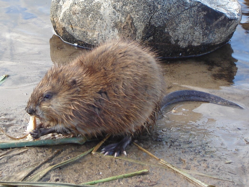
Muskrats are common across the state. While considerably bigger than plain old rats, they are nowhere near the size of beavers, which can get to 50 pounds. Muskrats have tails that are slightly flattened from side to side, unlike beavers which have broad flat tails. Both animals build conical houses in the water, but only beavers build dams.

-- Wikipedia


Beaver

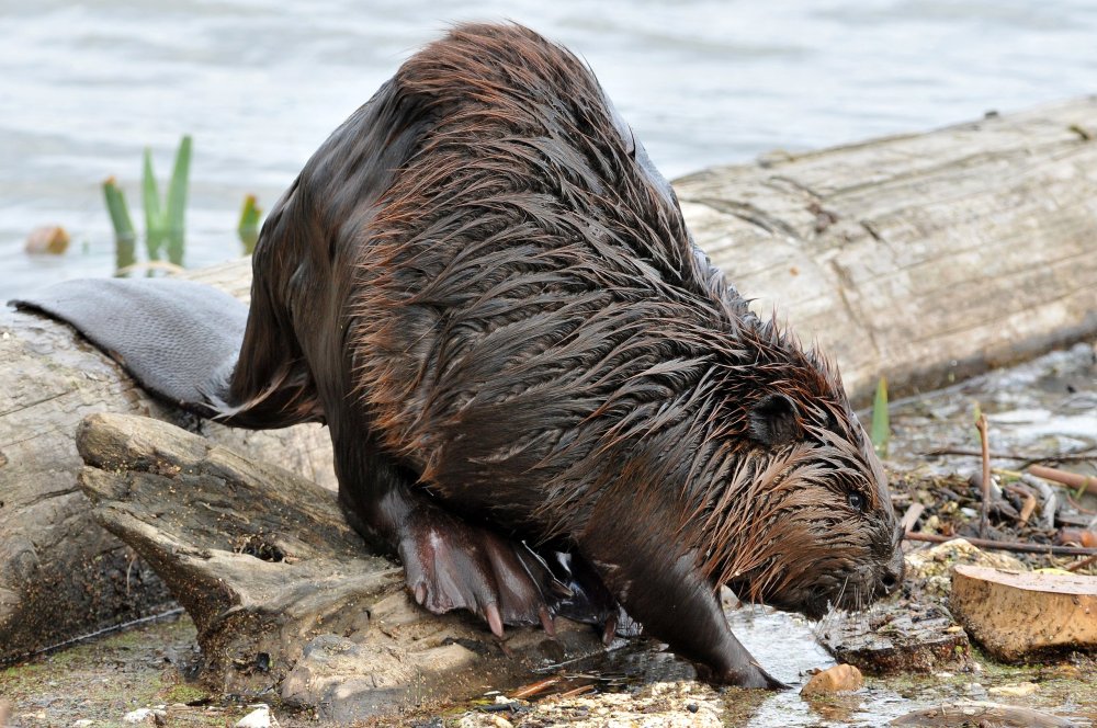
Beavers are once again common throughout the state and have supported an annual trapping season since 1970. This is not an animal that you want too close to your house though, as their dam-building can cause flooding, and they can do a great deal of damage to trees and vegetation.

-- Wikipedia


Cape May County
( 39.14000, -74.80000 )

  1. Bay Avenue - Ocean City ( 39.21643, -74.64678 )
  2. Cedar Swamp Creek (N) ( 39.26195, -74.70206 )
  3. Cedar Swamp Creek (S) ( 39.24889, -74.71257 )
  4. Delaware Bay - Bidwell Creek ( 39.12731, -74.89085 )
  5. Delaware Bay - East Point ( 39.19403, -75.02600 )
  6. Delaware Bay - Fortescue ( 39.22920, -75.16834 )
  7. Delaware Bay - Moore's Beach ( 39.18944, -74.95113 )
  8. Delaware Bay - Norbury's Landing ( 39.05033, -74.92742 )
  9. Delaware Bay - Sunset Beach ( 38.94432, -74.97012 )
  10. Delaware Bay - Thompson's Beach ( 39.19244, -74.99485 )
  11. Dennis Creek - Jake's Landing ( 39.17916, -74.85133 )
  12. East Creek Pond - Dennis ( 39.22333, -74.88656 )
  13. Gibson's Creek ( 39.35592, -74.72609 )
  14. Great Egg Harbor Bay - Beerdley's Point ( 39.28756, -74.62664 )
  15. Great Egg Harbor Bay - Somers Point (N) ( 39.31130, -74.59272 )
  16. Great Egg Harbor Bay - Somers Point (S) ( 39.30640, -74.60763 )
  17. Great Egg Harbor River - Camp Acagisca ( 39.49275, -74.76715 )
  18. Great Egg Harbor River - Mays Landing ( 39.44940, -74.72489 )
  19. Inside Thorofare - Atlantic City ( 39.35533, -74.45687 )
  20. Inside Thorofare - Ventnor ( 39.34593, -74.47623 )
  21. Jenkins Sound - Mayville ( 39.06281, -74.81961 )
  22. Lake Lenape - Mays Landing ( 39.46187, -74.73755 )
  23. Lake Nummy - Belleplain ( 39.24691, -74.85720 )
  24. Lakes Bay - Ventnor ( 39.35318, -74.48744 )
  25. Long Reach - Avalon ( 39.08144, -74.73862 )
  26. Longport Dog Beach ( 39.30741, -74.55738 )
  27. Ludlam Thorofare - Sea Isle City ( 39.14373, -74.70499 )
  28. Maurice River - Mauricetown ( 39.28730, -74.98763 )
  29. Maurice River - Milleville ( 39.37706, -75.03671 )
  30. Maurice River - Sharp St ( 39.40012, -75.05345 )
  31. Maurice River - Terrapin Cove ( 39.24547, -75.00404 )
  32. Miller Creek ( 39.25262, -74.62715 )
  33. Patcong Creek - Bargaintown Pond ( 39.36083, -74.57569 )
  34. Patcong Creek - Belhaven ( 39.34363, -74.58752 )
  35. Patcong Creek - New Road ( 39.30470, -74.62031 )
  36. Scull Bay - Bridge Out ( 39.34668, -74.55683 )
  37. Shaw's Mill Pond - Newton ( 39.31290, -75.15645 )
  38. Stephen Creek ( 39.38564, -74.73649 )
  39. Stephen Creek - Maple Lake ( 39.40547, -74.77808 )
  40. Stephen Creek - Stephen Lake ( 39.39556, -74.74907 )
  41. Strathmere Bay - Strathmere ( 39.19447, -74.66326 )
  42. Tennessee Ave - Ocean City ( 39.27051, -74.60393 )
  43. Tuckahoe River - Corbin City ( 39.29883, -74.75319 )
  44. Tuckahoe River - Tuckahoe ( 39.29545, -74.74010 )
  45. Union Lake - Millville (E) ( 39.40677, -75.05152 )
  46. Union Lake - Millville (W) ( 39.40812, -75.06712 )